
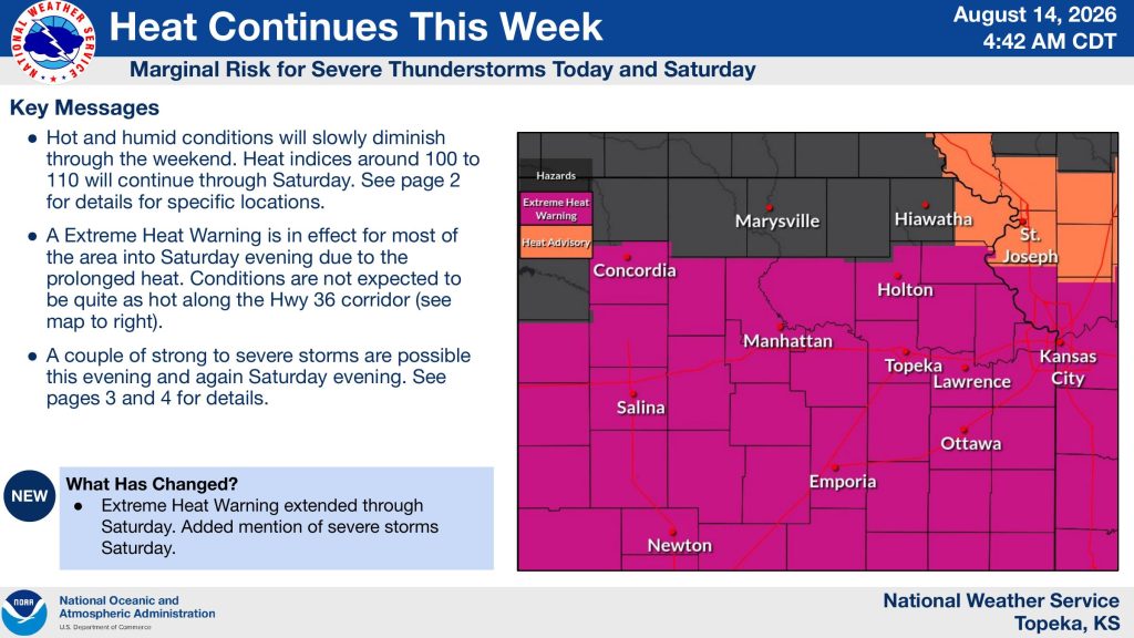


Dangerous heat will continue across the Manhattan area through Saturday, with another chance for strong to severe thunderstorms both Friday and Saturday evening.
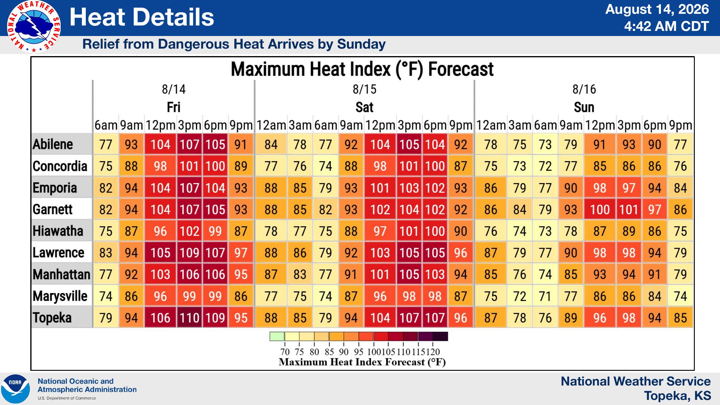
The National Weather Service in Topeka says an Extreme Heat Warning remains in effect for most of the area into Saturday evening. Heat index values in Manhattan are expected to reach about 106 degrees Friday afternoon and around 105 degrees Saturday before significantly cooler conditions arrive Sunday.
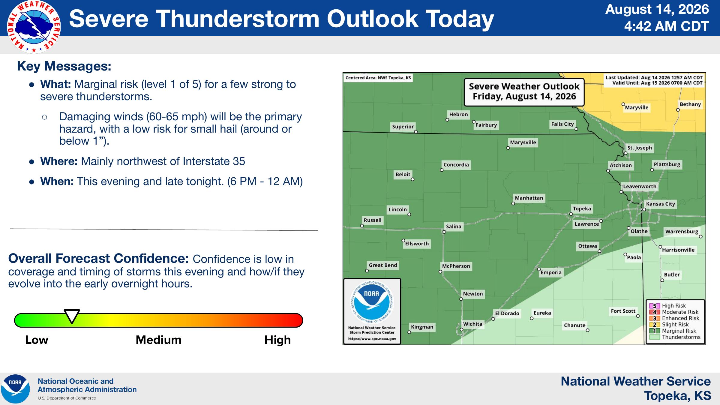
Forecasters also have the Manhattan area under a marginal risk, level 1 of 5, for severe thunderstorms Friday evening. Storms are possible between 6 p.m. and midnight, with damaging winds of 60 to 65 mph the primary threat. Small hail is also possible. Forecast confidence remains low on the exact coverage and timing of the storms.
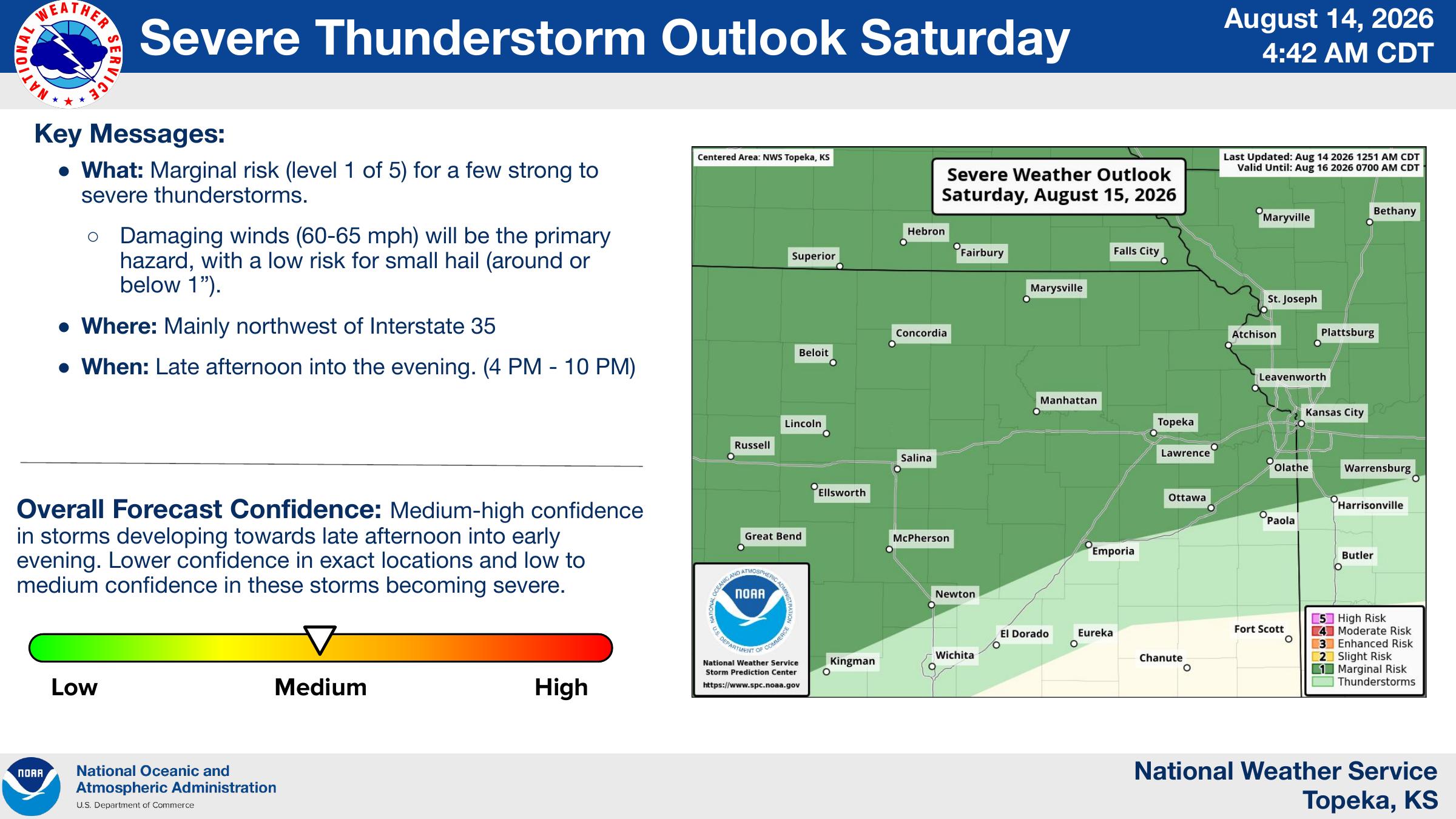
Another round of storms could develop Saturday between about 4 and 10 p.m. The National Weather Service again lists damaging winds as the main severe-weather threat, with a lower risk for small hail.
Relief from the prolonged heat is expected Sunday, when Manhattan’s afternoon heat index is forecast to remain in the low to mid-90s.
The post Manhattan faces 106-degree heat index, severe storm chances through Saturday appeared first on News Radio KMAN.
