

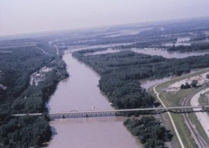
Kansas River looking Northwest toward Manhattan, 1993. (photo courtesy of the United States Geological Survey)
The 1993 Manhattan flood was 25 years ago Wednesday. The flood came after weeks of heavy rainfall filled the Tuttle Creek dam and forced officials to raise the spillway, releasing 68 thousand cubic feet of water per second which flowed into the city.
Manhattan’s flooding was not an isolated incident — storms led to floods across the midwest, including more than 50 Kansas counties according to Riley County Emergency Management Director Pat Collins, who stopped by a recent edition of KMAN’s In Focus.
“We had lots of rain that came in at different times and it kind of built up and filled up all the dams,” said Collins, who was the emergency management director during the flood as well. “We got about 15 days notice, which is when we started meeting on a regular basis and putting out information on flooding.”
Fifty people died and 70,000 people were left homeless as a result of the floods across the region that caused an estimated $12 billion in property and agricultural damages. Collins said there were no reported injuries or deaths in Manhattan as a direct result of the flood.
Tuttle Creek Lake withstood the inflow of water, but by July 1993 it was reaching capacity. There were some concerns in the community about its integrity. Officials decided to open the spillway to ensure the dam did not fail. This released 68,000 cubic feet of water per second, which flowed into the city.
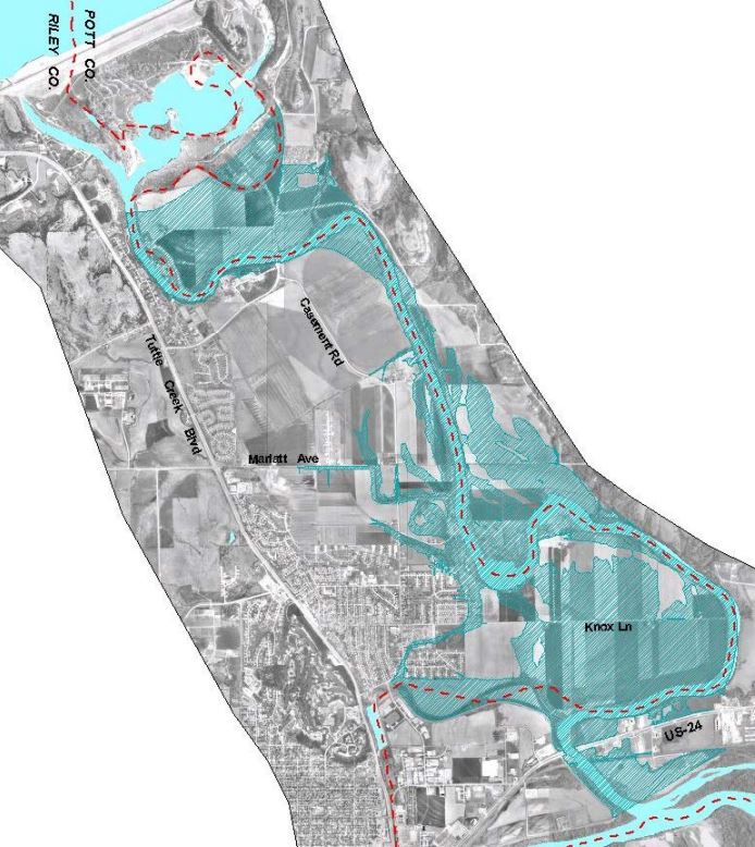
This map shows areas of Manhattan affected by the 1993 flood. (Photo courtesy of Riley County)
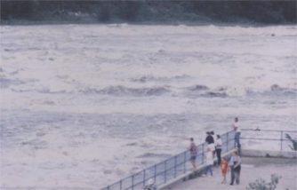
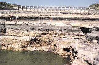
Video: Water pours from the overflow gates of Tuttle Creek Dam during the 1993 flood.
Collins said that at the time everybody seemed to blame the Tuttle Creek dam for the flooding.
“We had at least three, if not four, hundred-thousand cubic foot inflows into Tuttle Creek,” Collins said. “The dam actually held back 3 to 4 prior floods that would have come down if we didn’t have the dam.”
Collins said that raising the flood gate also raised the elevation of the lake another four to six inches, holding back “more water yet that could have caused additional flooding.”
He said the Tuttle dam as well as the Milfod Lake dam served their purposes and ended up saving a lot of properties. Even so, Manhattan was not without property damage. Collins didn’t have exact numbers on the damage, but he said almost 400 flood-prone residences were bought out through a FEMA program to prevent them from being flooded again.
“The big amount of flooding was Hunter’s Island,” Collins said. “There were a few little islands out there, but it was water as far as you could see looking over that Wildcat Creek bridge going on South Manhattan Avenue.”
Link: United States Geological Survey report on the flood and comparison the the 1903 Kansas flood.
The community response to the flood was tremendous, according to Collins. He said “people just came out of the woodwork to come sandbag for days to help people protect their property.
“The people in Manhattan and Riley County are really resilient,” said Collins. “They go to great odds to go out and help each other and help the people having a problem or getting flooded — and we saw that.”
Collins said Riley County Emergency Management has since put a lot of emphasis on preparedness and informing community members — new and old — of flood danger. He also said there are now sirens, including voice sirens in certain areas, to notify residents of floods.
He also said that since the flood, local, state and federal organizations have worked together to create new flood maps for the Blue River and Wildcat Creek. These were used to create a new tool that allows residents to see whether their residence will be affected by a potential flood. You can check out the flood prediction tool on the City of Manhattan website.

The post Collins: ’93 flood showed ‘resilience’ of Manhattan, Riley County communities appeared first on News Radio KMAN.