
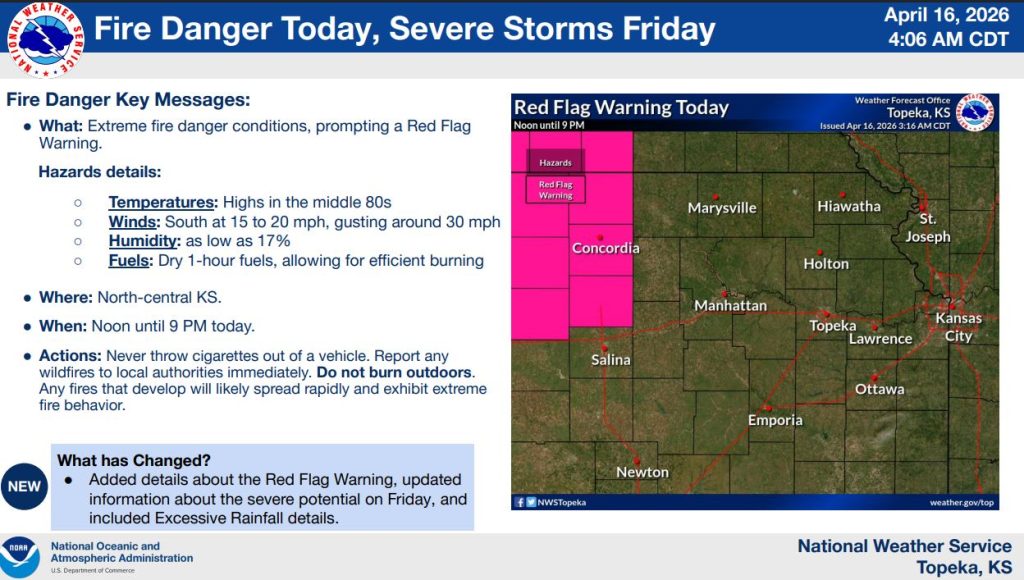


Extreme fire danger is expected across parts of north-central Kansas today, prompting a red flag warning from the National Weather Service in Topeka.
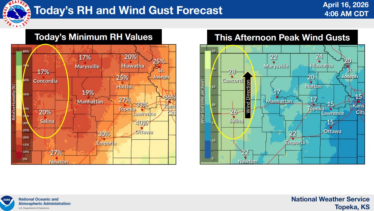
Forecasters say conditions will be favorable for rapid fire growth, with afternoon high temperatures in the mid-80s, south winds between 15 and 20 mph with gusts up to 30 mph, and relative humidity dropping as low as 17%.
The warning is in effect from noon through 9 p.m., with the greatest concern centered across north-central portions of the state.
Officials warn that any fires that develop could spread quickly and exhibit extreme behavior due to dry fuels and windy conditions. Residents are urged not to burn outdoors and to avoid actions that could spark a fire, including discarding cigarettes from vehicles.
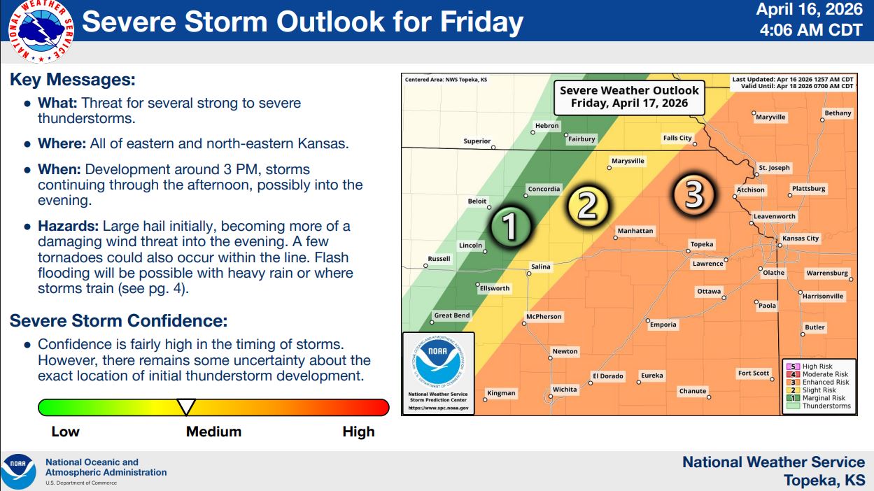
Looking ahead, attention turns to Friday, when a strong storm system is expected to bring the potential for severe weather across eastern and northeastern Kansas.
Storms are expected to develop around 3 p.m. and continue through the afternoon and evening, bringing hazards that include large hail, damaging winds and the possibility of a few tornadoes.
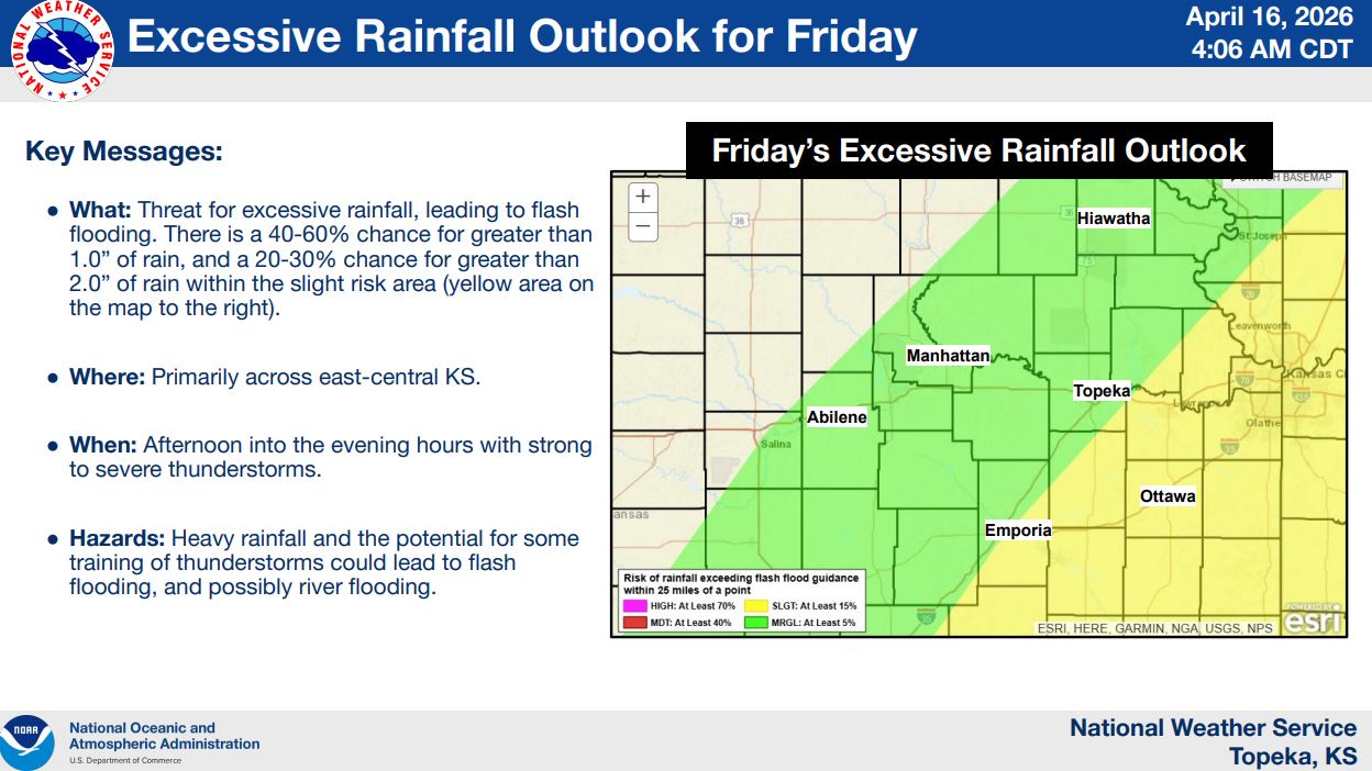
Heavy rainfall is also a concern, with a 40% to 60% chance of at least one inch of rain and a 20% to 30% chance of more than two inches in some areas, which could lead to flash flooding or river flooding.
Stay tuned to News Radio KMAN for the latest updates.
The post Extreme fire danger today, severe storms possible Friday appeared first on News Radio KMAN.