


A light wintry mix could create minor travel issues across parts of the region Sunday, according to the latest forecast.
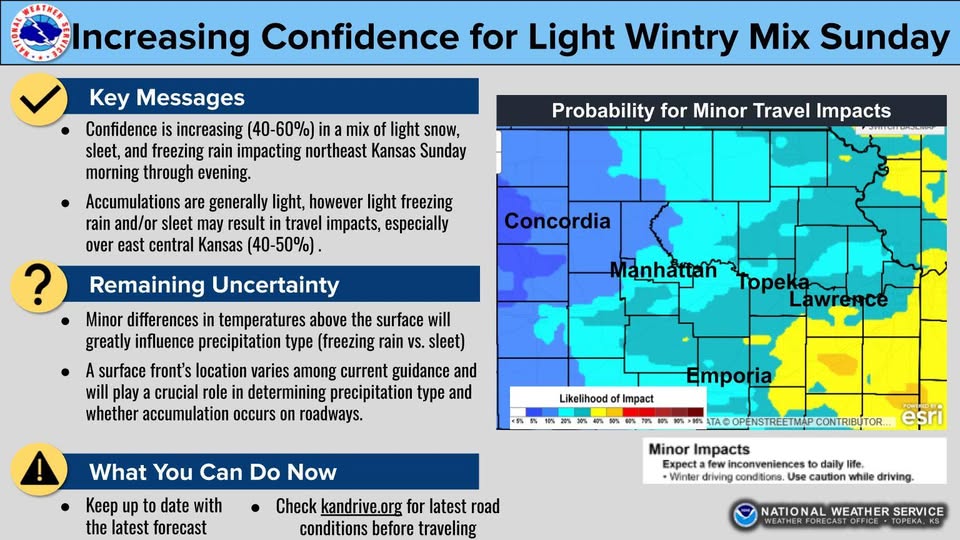
Forecasters say confidence is increasing that snow, sleet and freezing rain will develop Sunday morning and continue through the evening hours. The greatest potential for minor travel impacts is currently focused over east-central Kansas, where probabilities range between 40% and 50%.
Meteorologists caution that details remain uncertain. Small differences in temperatures at and just above the surface could significantly affect precipitation type and accumulation amounts. Forecast models continue to vary on how much snow, sleet or ice may fall and exactly where the heaviest impacts could occur.
While widespread significant accumulation is not expected at this time, even light ice or sleet can create slick road conditions, particularly on bridges and overpasses.
The post Light Wintry Mix Possible Sunday Across East-Central Kansas appeared first on News Radio KMAN.