

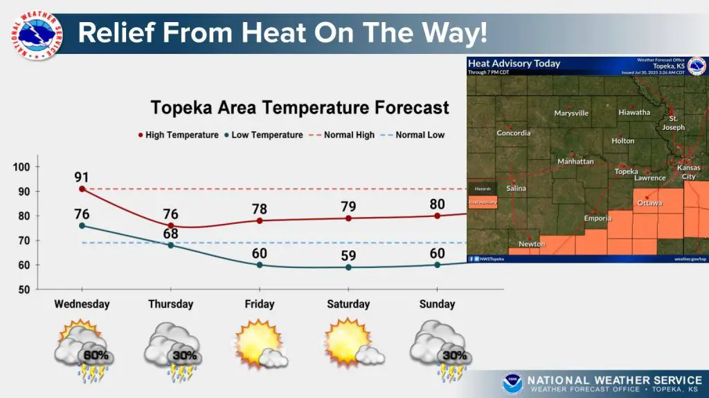

The region is expecting one final round of intense heat today before a cold front moves in and brings a welcome cooldown.
Heat indices are expected to climb between 100 and 105 degrees today, especially along and southeast of the Kansas Turnpike. A cold front will move through the area later, bringing a noticeable drop in temperatures beginning Thursday.
Scattered, non-severe thunderstorms are possible both this morning and again later this afternoon into the evening. Forecasters say the main hazards will be frequent lightning and wind gusts of up to 50 miles per hour.
Highs will drop into the 70s starting Thursday, offering a much-needed break from the recent heat just in time for the weekend.
Click here for more local news.
The post Relief ahead as cold front moves into Flint Hills appeared first on News Radio KMAN.