

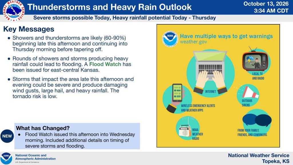


Severe thunderstorms could bring damaging winds, large hail and heavy rainfall to northeast and east-central Kansas Tuesday afternoon and evening, with flooding becoming a greater concern overnight and into Thursday.
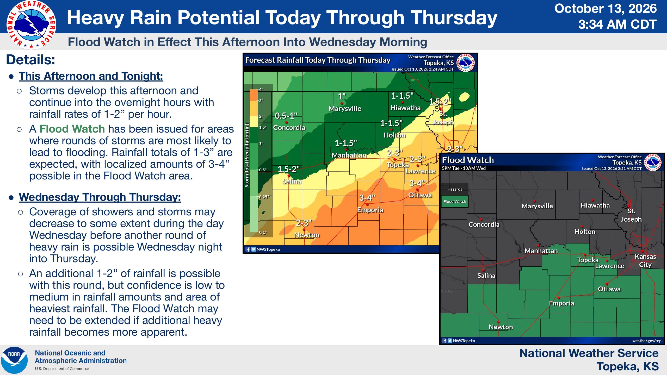
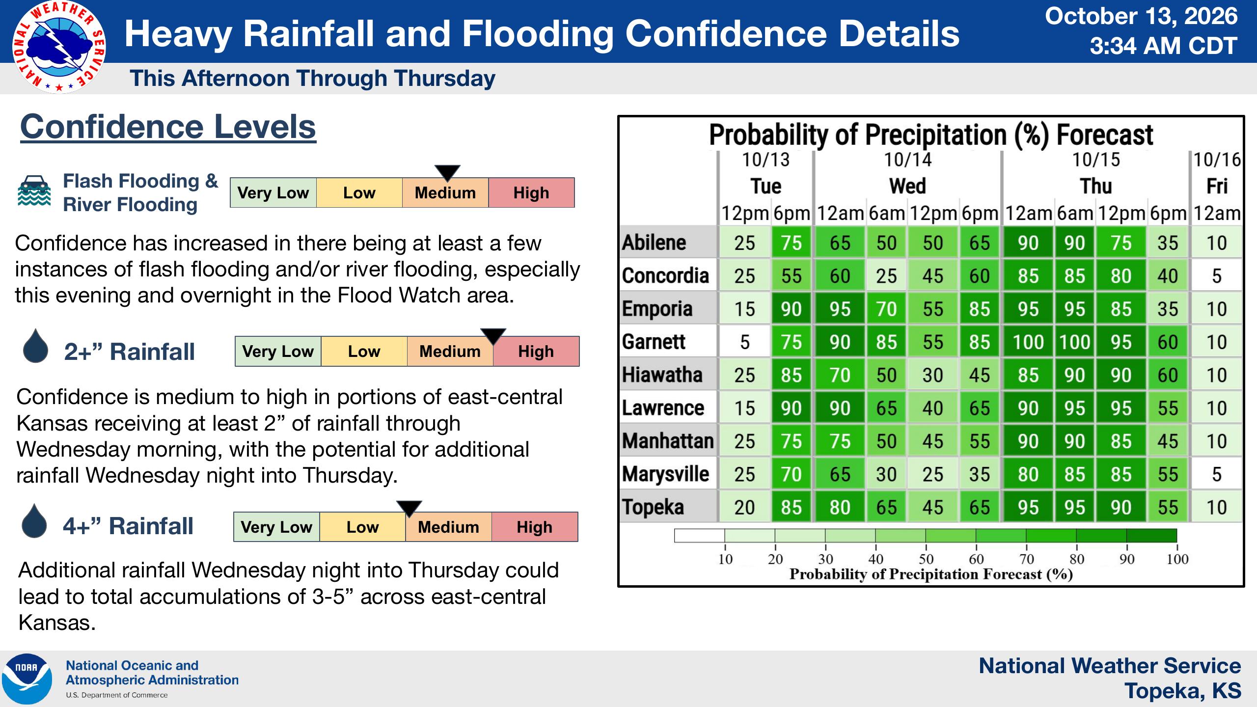
The National Weather Service in Topeka has issued a Flood Watch for portions of east-central Kansas from Tuesday afternoon through Wednesday morning. Forecasters say multiple rounds of thunderstorms could produce 1 to 3 inches of rain, with localized amounts of 3 to 4 inches possible in the watch area.
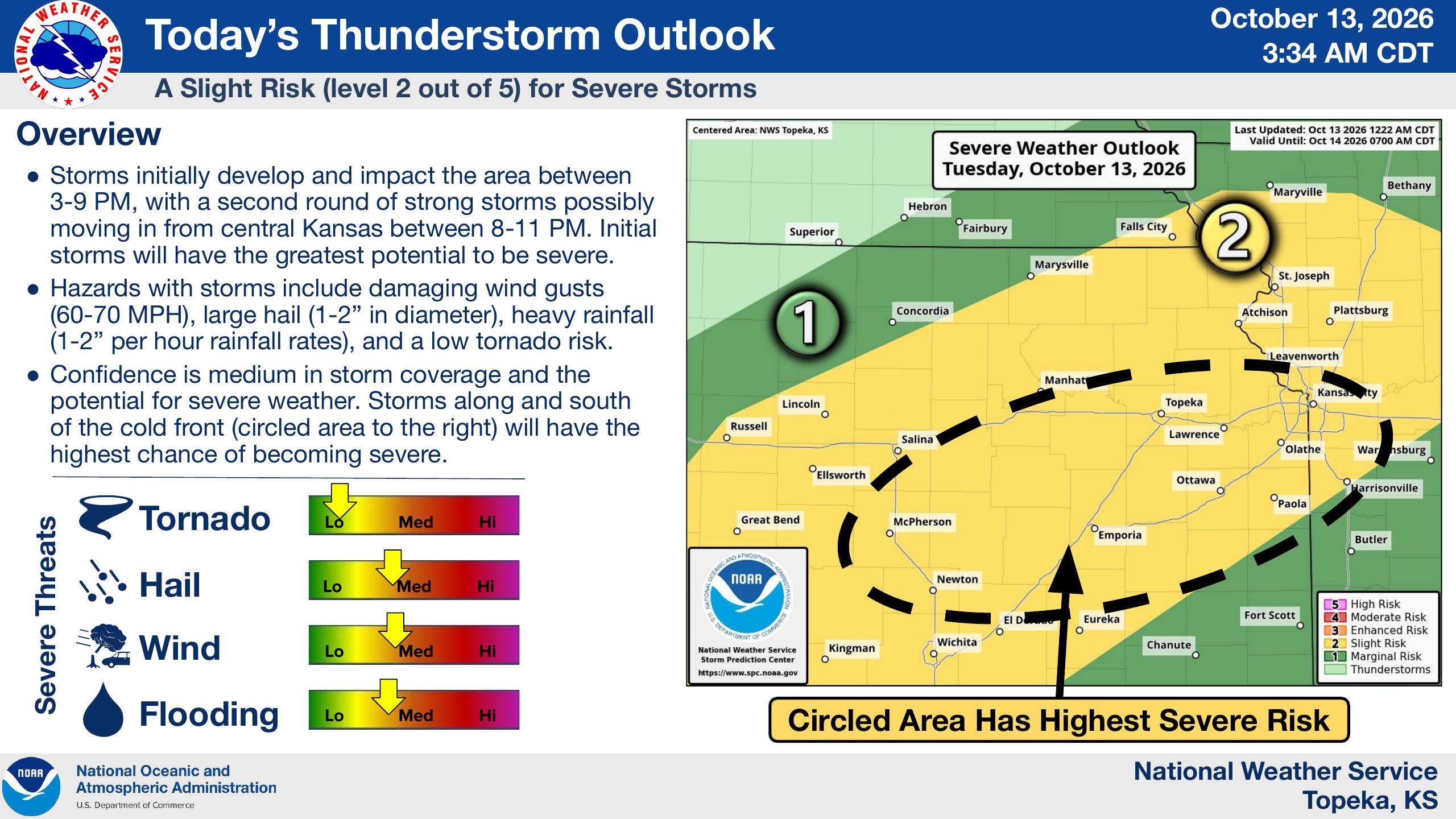
A slight risk, or Level 2 of 5, for severe thunderstorms remains in effect Tuesday for much of the region, including Manhattan, Junction City and Topeka.
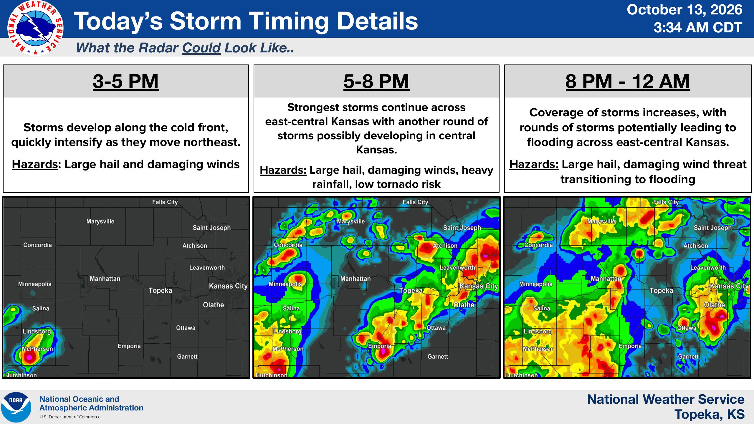
Storms are expected to develop along a cold front between 3 and 5 p.m., intensifying as they move northeast. The strongest storms are expected between 5 and 8 p.m., with another round of strong storms potentially moving into the region from central Kansas between 8 and 11 p.m.
Forecasters say storms could produce wind gusts of 60 to 70 mph, hail between 1 and 2 inches in diameter and rainfall rates of 1 to 2 inches per hour. The tornado risk is considered low.
The threat is expected to transition toward flooding Tuesday night as additional storms develop. Rain chances remain high through Thursday, with another round of heavy rainfall possible Wednesday night into Thursday.
The Weather Service says an additional 1 to 2 inches of rain could fall during that period, potentially bringing storm-total rainfall to 3 to 5 inches in portions of east-central Kansas. Confidence has increased in the potential for flash flooding and river flooding, particularly in areas under the Flood Watch.
According to the latest forecast, Manhattan could receive between 1 and 1.5 inches of rain through Thursday, with higher totals possible farther south and east.
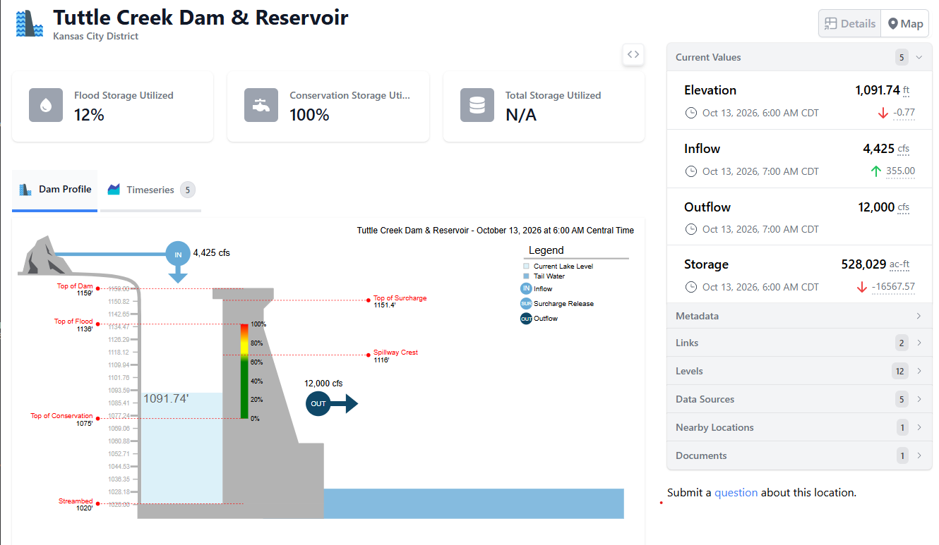
Meanwhile, the U.S. Army Corps of Engineers reported Tuesday morning that Tuttle Creek Reservoir was utilizing 12% of its flood storage capacity, down from 13% Monday.
As of 6 a.m. Tuesday, the reservoir’s elevation stood at 1,091.74 feet, down from 1,092.44 feet Monday morning.
Inflows were measured at 4,425 cubic feet per second Tuesday morning, while outflows remained at 12,000 cubic feet per second.
Stay tuned to News Radio KMAN for the latest weather updates.
The post Severe storms, flooding rain expected Tuesday; Flood Watch issued for east-central Kansas appeared first on News Radio KMAN.
