
Severe weather is a possibility for the region through Saturday.
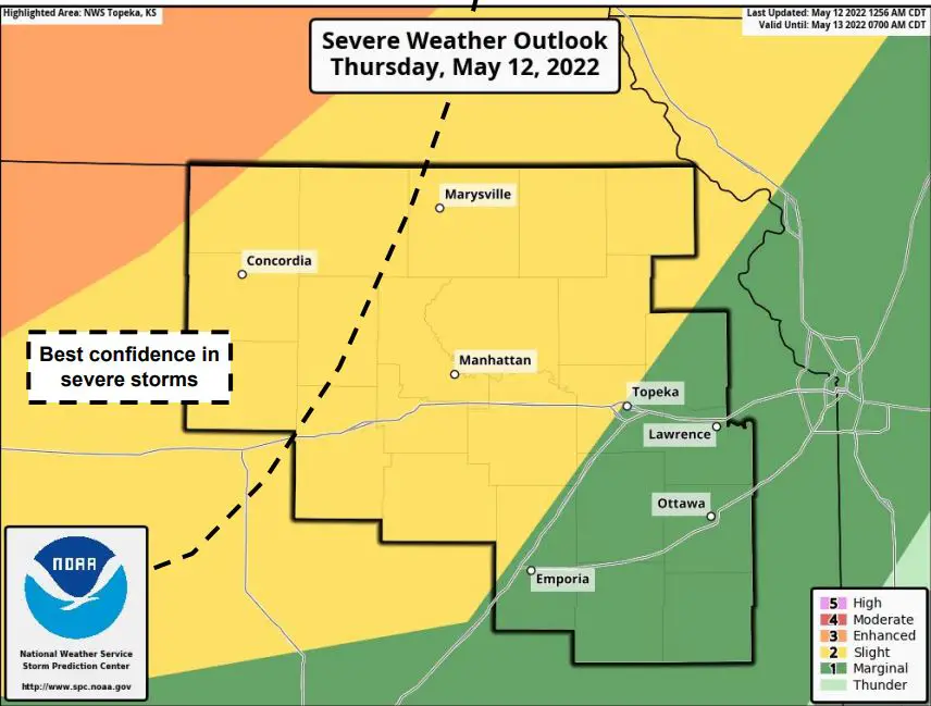
The National Weather Service says a cold front will push through today and thunderstorms are expected to develop along a boundary that could move into north central Kansas, which will weaken as they move eastward. The weaker storms will likely continue into Friday morning. It’s anticipated that the hazards would be damaging winds of 60 mph and large hail up to an inch in diameter. Forecasters aren’t as certain about how quickly storms will weaken. A slight (level 2) risk for severe storms is in place for the Manhattan area today.
Storms are expected to redevelop Friday afternoon into the evening. Damaging winds and large hail would be the main concerns, though Manhattan is in a marginal (level 1) risk for severe storm development Friday.
The region moves back into a slight risk for severe weather on Saturday.
To view the Convective Outlook from the Storm Prediction Center, visit spc.noaa.gov.
The post Severe weather a possibility through the weekend appeared first on News Radio KMAN.