
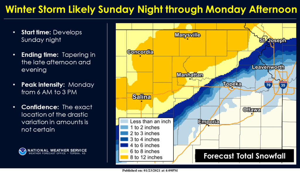
NWS Topeka courtesy graphic (as of 4:09 p.m. Jan. 23, 2021)
Manhattan has largely avoided much of Old Man Winter this season, but that could change as a winter storm bears down on much of north central Kansas and the Central Plains region Sunday night into Monday.
The National Weather Service has issued a winter storm watch for the Manhattan area, including Riley, Geary, Pottawatomie and Wabaunsee counties from late Sunday night through Monday afternoon.
Significant snowfall is likely for much of the area, with forecasters predicting 8 to 12 inches of snow in areas from Salina to Holton. That extends to portions of northern Riley and Pottawatomie counties. Manhattan could see between 6 to 8 inches if the forecast models hold true.
Light drizzle and freezing drizzle are possible Sunday evening with precipitation changing over to a wintry mix of light freezing rain and snow overnight then to mostly snow north of Interstate 35 Monday morning through late afternoon. Heavier snow amounts are expected further north, according to the Weather Service.
Travel could be treacherous, so those planning to travel Sunday or Monday, should likely consider alternative plans. The peak times for snowfall are forecasted to be between 6 a.m. and 3 p.m. Monday.
Be sure to check KMAN’s Closings and Delays page for updates and announcements as they become available.
The post Winter storm likely to impact Manhattan, north-central Kansas appeared first on News Radio KMAN.