
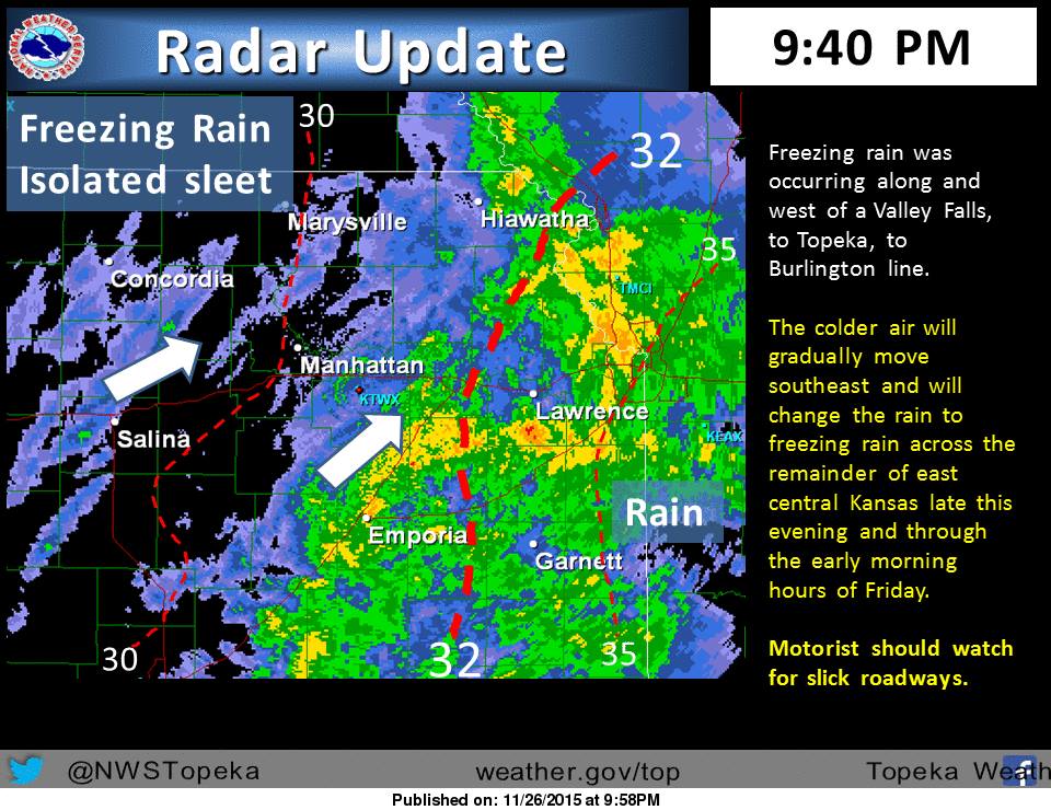
(Photo Courtesy of National Weather Service, Topeka)
The Freezing line late Thursday night extended from Valley Falls, to Topeka, to east of Burlington. West of this line periods of freezing rain with isolated sleet showers were occurring. Road temperatures will continue to cool and ice will begin forming on roadways through the night. The freezing line will gradually move southeast across the remainder of east central Kansas through the early morning hours of Friday, which will begin to turn the rain across the remainder of east central Kansas over to periods of freezing rain. Motorists should use caution as ice will begin to form on roadways, especially bridges and overpasses. Ice accumulations will generally be around 0.2” across northeast and east central Kansas Tonight. There may be some isolated power outages. Winds may increase to 15 to 20 MPH during the morning hours. The heavier precipitation was beginning to end across north central Kansas, though freezing drizzle and scattered freezing rain showers may continue through the remainder of Tonight.