
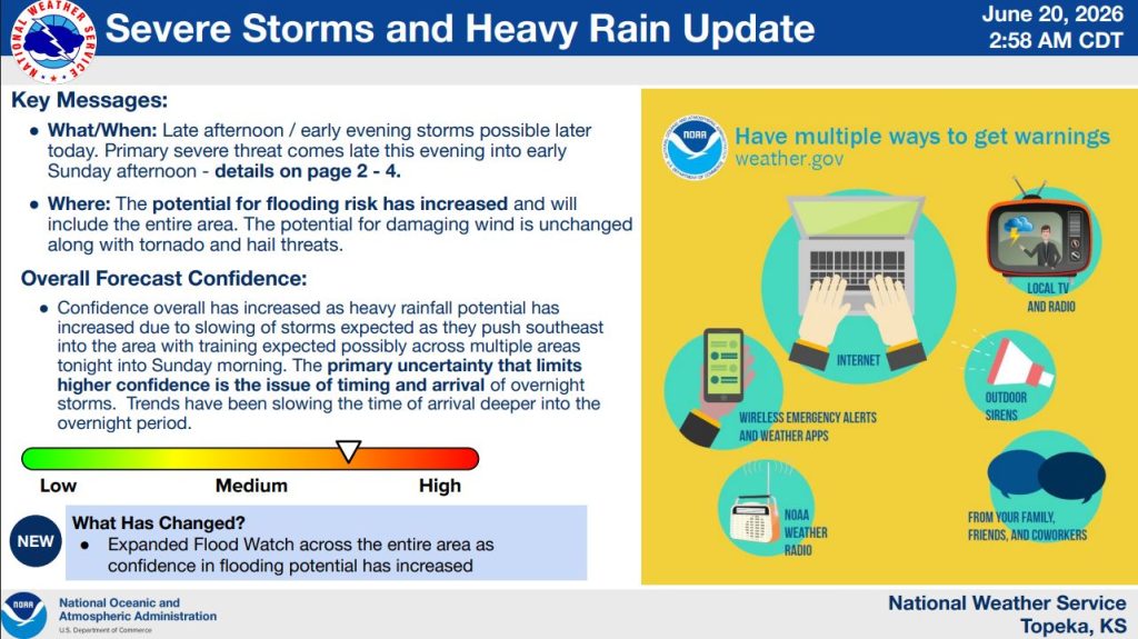


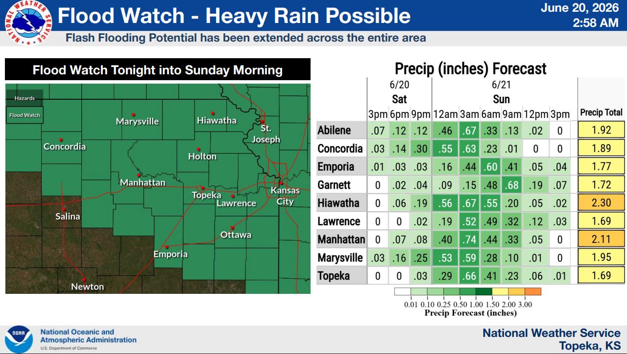
The National Weather Service has expanded a Flood Watch to include all of northeast Kansas as confidence grows in the potential for heavy rainfall and flash flooding Saturday night into Sunday morning.
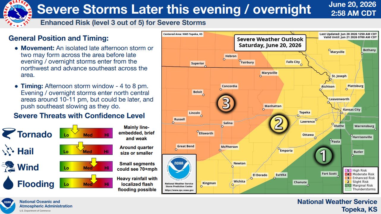
An Enhanced Risk (Level 3 of 5) remains in effect for severe storms Saturday evening and overnight. Damaging winds up to 70 mph, quarter-sized hail, localized flooding and a low-end tornado threat are possible.
Isolated storms may develop between 4 and 8 p.m., with the main storm complex expected to arrive between 10 and 11 p.m. and continue through the overnight hours.
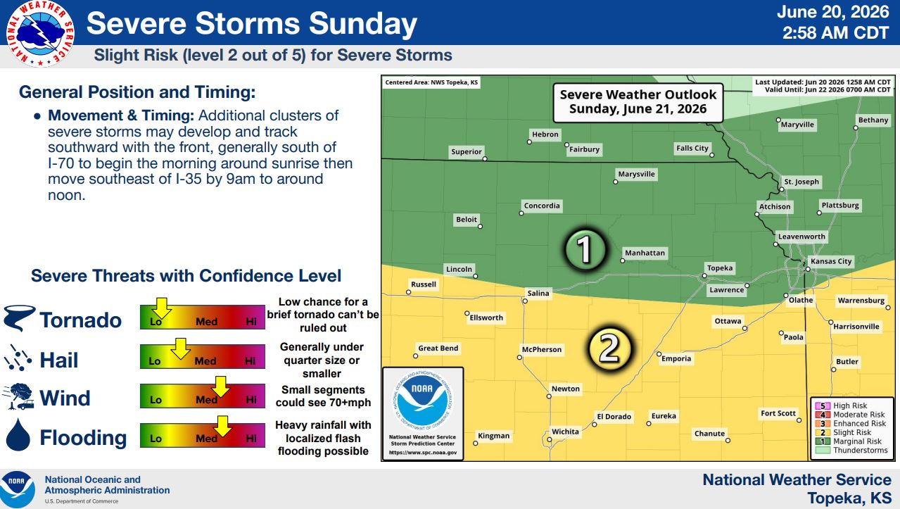
Additional severe storms are possible Sunday morning, mainly south of I-70, with damaging winds and flash flooding remaining concerns.
Stay tuned to News Radio KMAN for the latest updates.
The post Flooding, severe storm threat increases for Saturday night appeared first on News Radio KMAN.