
The potential exists for wintry weather Sunday that could also have an impact on holiday travel.
NWS Topeka courtesy graphic
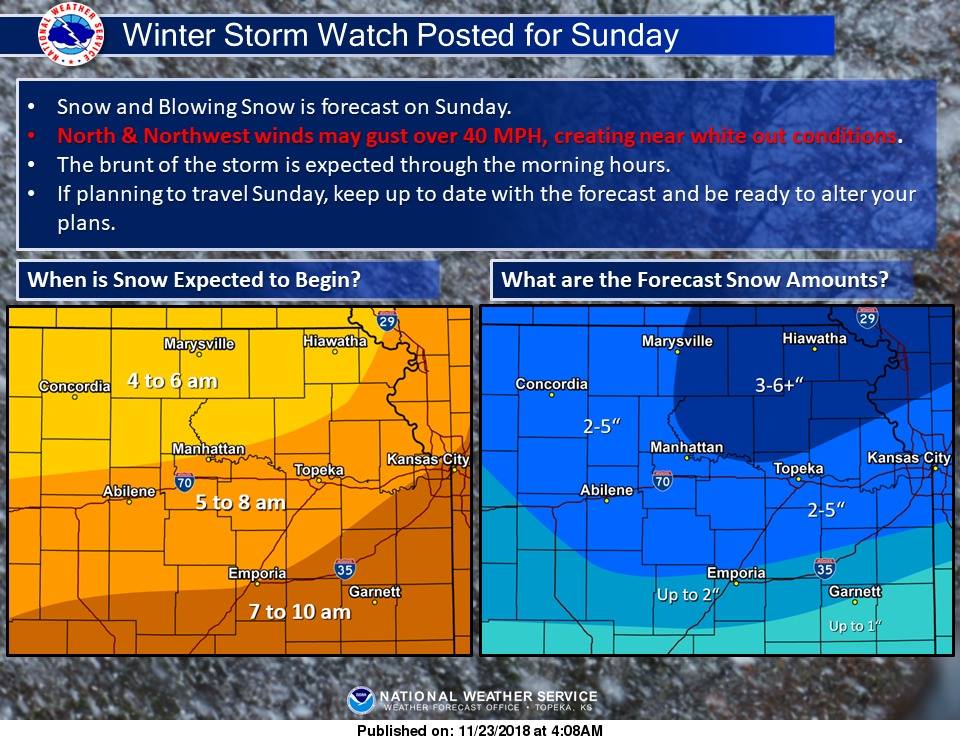
The National Weather Service Office in Topeka has issued a Winter Storm Watch for the northern half of Kansas including Riley, Pottawatomie and Geary counties from late Saturday night through Sunday afternoon.
How much snow we see is still uncertain, but meteorologists are expecting rain to develop after midnight Sunday and the storm to develop by mid-morning (5 to 8 a.m. in Manhattan) and out of the area by Sunday evening. Winds will also be strong, with gusts between 30 to 45 mph which will likely cause blizzard conditions. Most of the Manhattan area is expected to see between 2 to 5 inches while areas to the north and east including most of Pottawatomie County could see 3 to 6 inches, with locally heavier amounts possible.
Questions remain about the track of the storm and where the heaviest snow will be. The Weather Service says regardless, the strong winds anticipated with this storm will make travel dangerous with severely restricted visibility.
Be sure to stay alert of the forecast and adjust your travel plans as needed.
The post Heavy snow expected to impact end of holiday weekend travel appeared first on News Radio KMAN.