
NWS Topeka graphic
MANHATTAN — Mother Nature is not done blasting our area with winter weather.
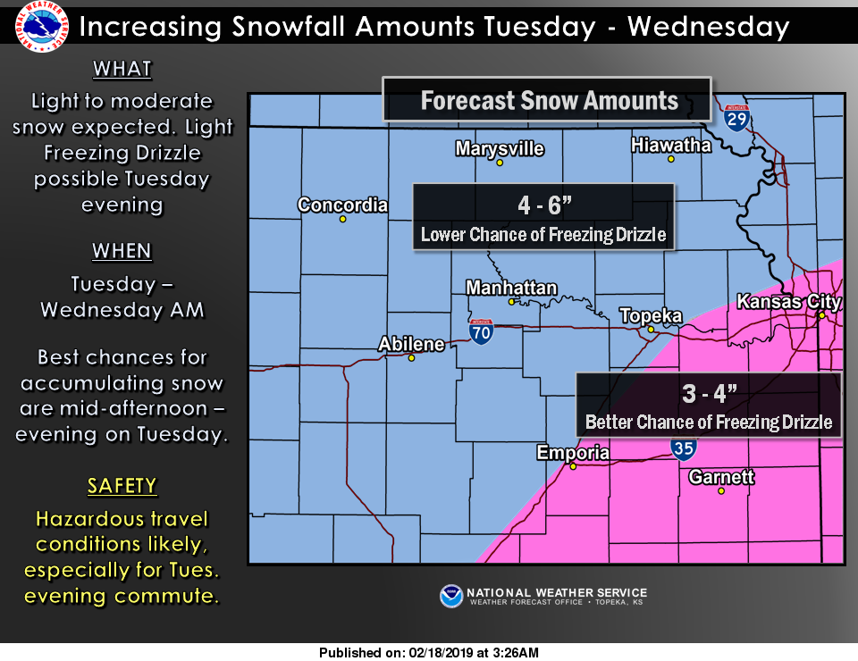
Days after a system dumped between 2.5 to 3.5 inches of snow in Riley County and up to 5 inches near St. George in Pottawatomie County, equal of higher amounts are possible with the next system set to arrive in our area Tuesday. The National Weather Service says 4 to 6 inches of snow are possible Tuesday evening into Wednesday for the greater Manhattan area. The best chances for accumulation will be mid-afternoon to mid-evening on Tuesday.
A lesser chance of freezing drizzle is possible with this storm, although the better chance for that exists further south and east near the Kansas Turnpike. Forecasters are saying this could be one of the more significant snow storms of the season.
It’s already been one of the snowiest winters in Kansas in recent memory. In Manhattan specifically already 20.6 inches of snow has fallen this season. To put that in perspective, Manhattan’s normal snowfall through Feb. 17 is 13.0 inches.
Another round of winter weather is anticipated by the weekend as well.
The post More snow on the way; Manhattan now over 20 inches total this winter appeared first on News Radio KMAN.