
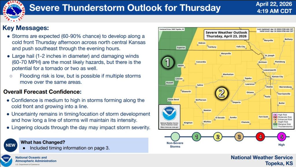


Strong to severe thunderstorms are expected to develop across north-central Kansas Thursday afternoon as a cold front moves through the region, according to the National Weather Service in Topeka.
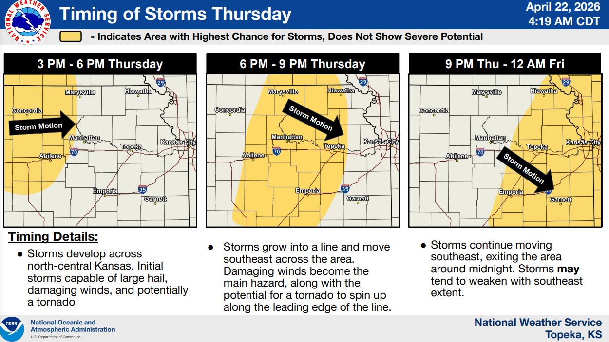
Forecasters say there is a 60% to 90% chance storms will form along the front before pushing southeast through the evening hours. Initial storms are expected to develop between 3 p.m. and 6 p.m., with activity continuing across the area into the evening and exiting around midnight.
The primary hazards include large hail up to 1 to 2 inches in diameter and damaging wind gusts between 60 and 70 mph. There is also the potential for a tornado or two, particularly as storms organize into a line moving southeast.
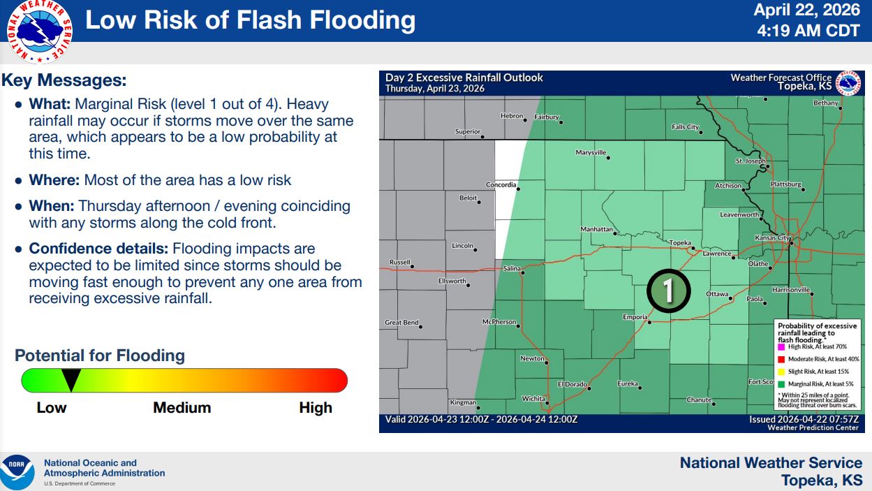
While the risk for flooding remains low, forecasters say localized heavy rainfall is possible if multiple storms track over the same areas.
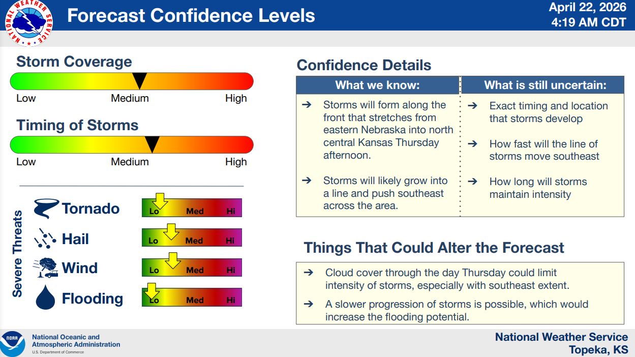
Confidence is medium to high that storms will develop along the front, though uncertainty remains regarding the exact timing and location of initial storm development and how long storms will maintain their intensity. Lingering cloud cover during the day could also limit the severity of storms in some areas.
Stay tuned to News Radio KMAN for the latest severe weather updates.
The post Severe storm chances return to the area Thursday appeared first on News Radio KMAN.