
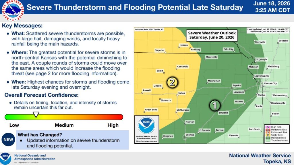


The National Weather Service in Topeka is warning that severe thunderstorms and flooding are possible across northeast Kansas late Saturday and into the overnight hours. Forecast confidence remains moderate, though details on the timing, location and intensity of storms are still uncertain.
Forecasters say scattered severe thunderstorms could develop Saturday evening, bringing the potential for large hail, damaging winds and locally heavy rainfall. The greatest threat for severe weather is expected across north-central Kansas, with the risk gradually decreasing farther east.
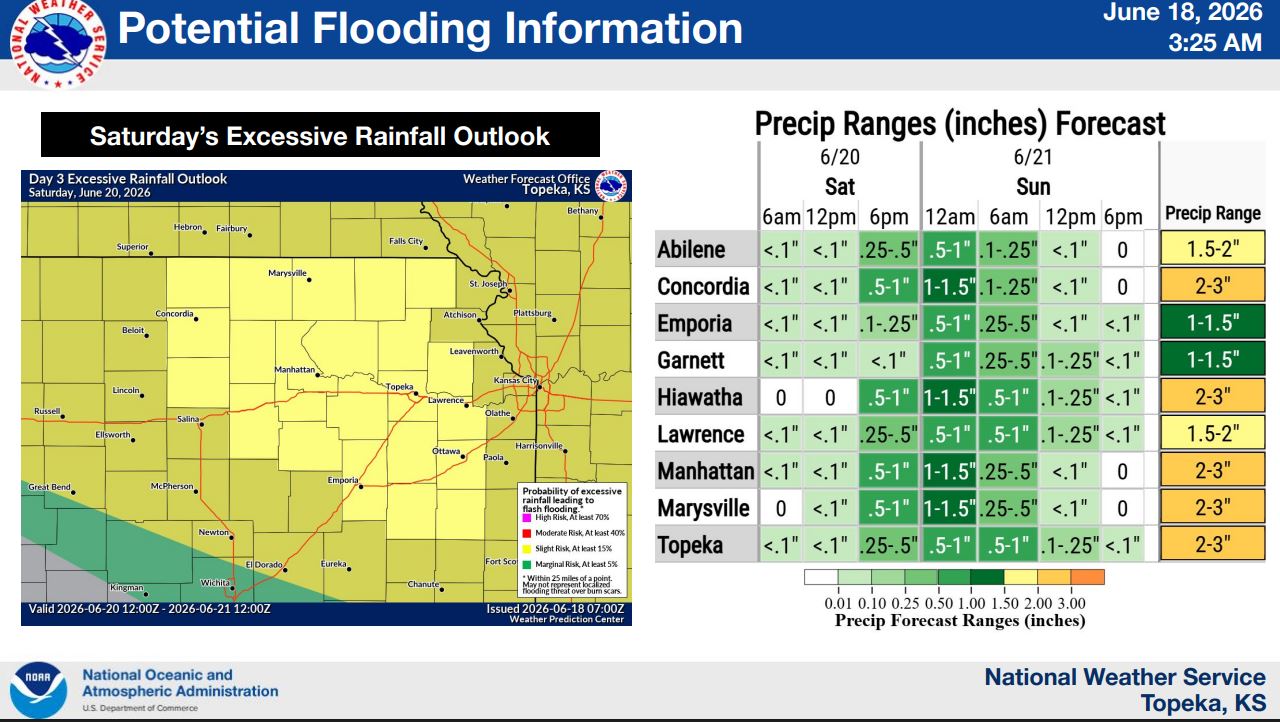
The weather service also highlighted the possibility that multiple rounds of storms could track over the same locations, increasing the threat for flash flooding and flooding concerns.
According to the rainfall outlook included in the briefing, Manhattan is forecast to receive between 2 and 3 inches of rain from Saturday through Sunday, while much of northeast Kansas is expected to see between 1.5 and 3 inches. The region is included in a slight risk area for excessive rainfall, meaning flash flooding could become a concern if storms repeatedly move over the same areas.
The highest chances for both severe weather and flooding are expected late Saturday evening and overnight. Residents are encouraged to remain weather aware and have multiple ways to receive watches and warnings.
The post Severe storms, flooding possible Saturday night across northeast Kansas appeared first on News Radio KMAN.