
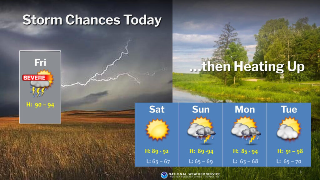
Severe storms are in the forecast for the Manhattan area Friday.
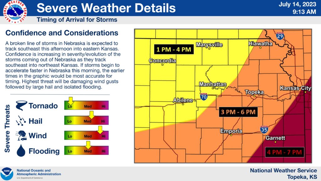
According to the National Weather Service, the focus for storm development shifts to southern Nebraska as a line late morning storms enter northeast Kansas and will greatly depend on how the low level moisture recovers from storms in Oklahoma Friday morning.
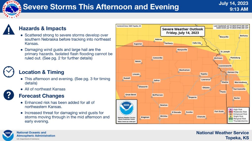
The Storm Prediction Center has placed Riley, Pottawatomie, and Geary counties into an Enhanced (Level 3) risk for severe weather Friday evening with the main threats being large hail (up 2 inch diameter), and damaging winds. Isolated flash flooding can’t be ruled out.
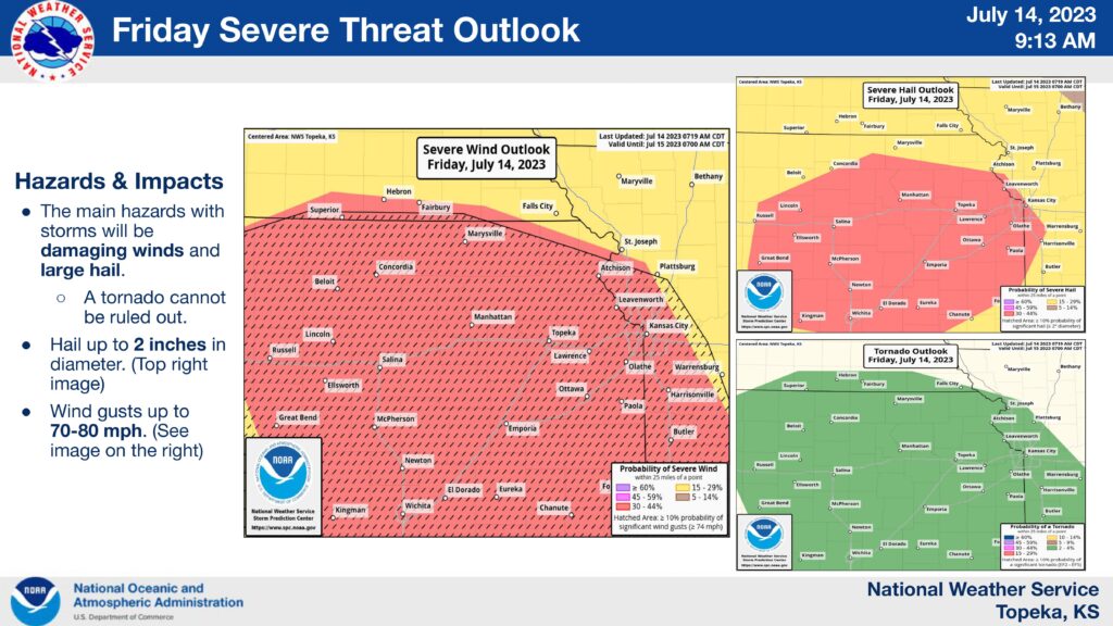
A broken line of storms forming in Nebraska is expected to move southeast during the afternoon into eastern Kansas. There is increased confidence that storms will become more severe and will evolve as they track into the area. If storms accelerate faster in Nebraska during the morning, we may see these storms in the Manhattan area as early as 1 pm.
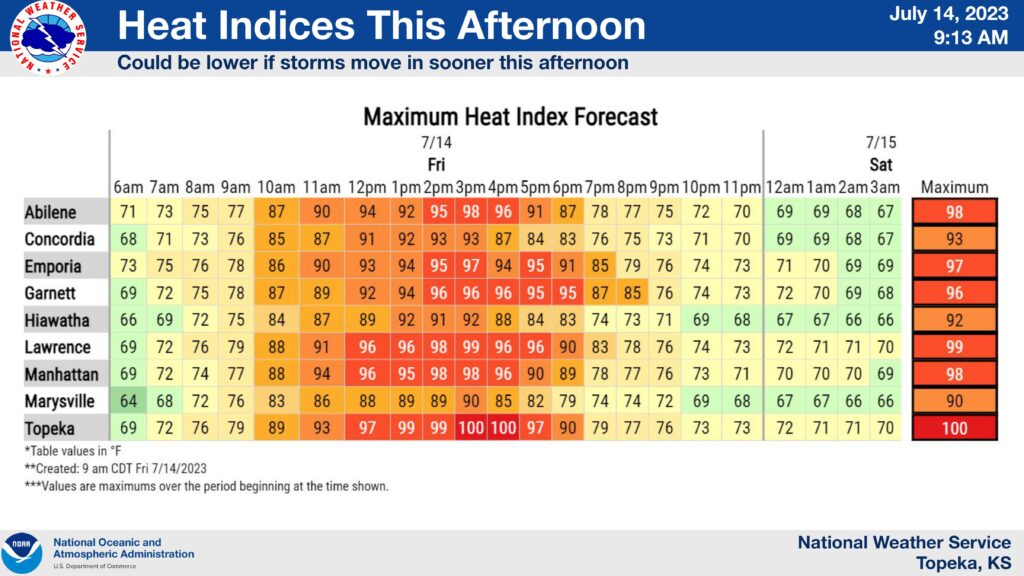
In addition to severe storms, Friday is also expected to be hot during the day before storm development, reaching our top temperature of 98 near 2 pm.
It’s advised to always make sure you have a plan in case of an emergency kit which may include any of the following:
- Backpack or storage tub to hold your supplies
- Bottled Water (recommended 1 gal per person)
- Non-Perishable Food (include a can opener if using canned food, and pet food if you have pets)
- Flashlight and extra batteries
- Hand-crank/Battery powered radio for updated information
- A first aid kit, including any medications.
As always you may tune into News Radio KMAN, or any of our Manhattan Broadcasting family of stations whenever severe weather strikes to get the latest information.