
NWS Topeka graphic (02-14-19)
TOPEKA — Another round of winter precipitation is on its way this weekend.
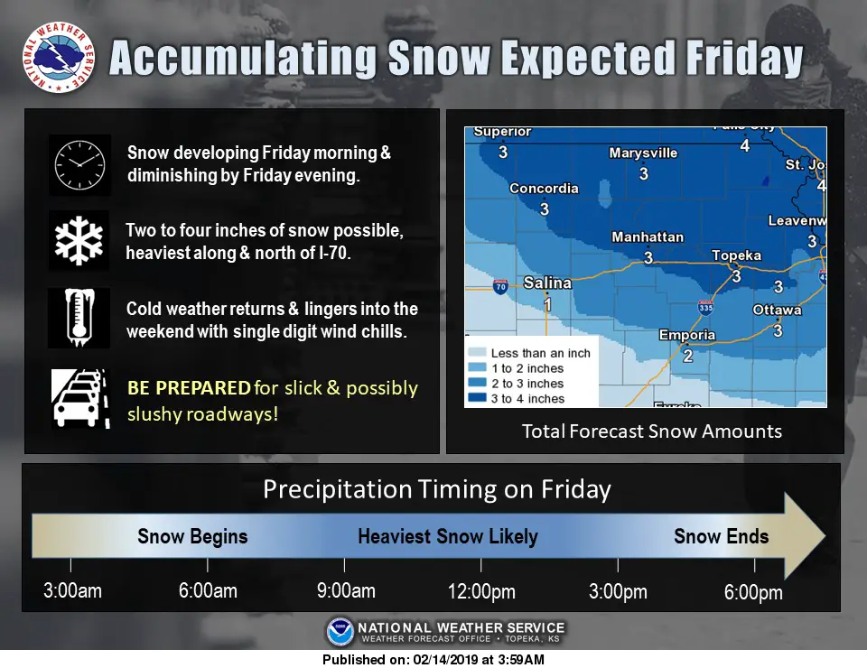
The National Weather Service says a Winter Weather Advisory will go into effect at 6 a.m. Friday and continue through 6 p.m. Friday for the entire region. Snow will develop Friday morning and will likely be at its heaviest during the mid-morning to mid-afternoon time frame. Two to four inches of snow are possible with the heaviest accumulations expected along and north of Interstate 70. Temperatures will plummet Thursday as the cold front moves in and highs will struggle on Friday to get out of the teens.
It’s already been a difficult winter on road crews in the area. In a Facebook post earlier this week, the City of Manhattan says it has seen significantly more potholes this year. In January, crews patched a total of 2,502 potholes. In January 2018, that number was 94. Motorists are urged to drive with caution as travel could be hazardous.
Lesser chances of snow are also possible Saturday afternoon and evening.
The post More snow possible Friday, Saturday appeared first on News Radio KMAN.