
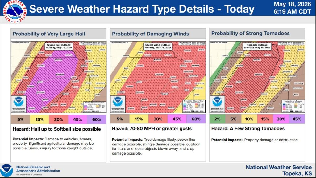


The National Weather Service in Topeka is warning of a significant severe weather outbreak Monday across northeast Kansas, with strong tornadoes, softball-sized hail, destructive winds and flash flooding all possible.
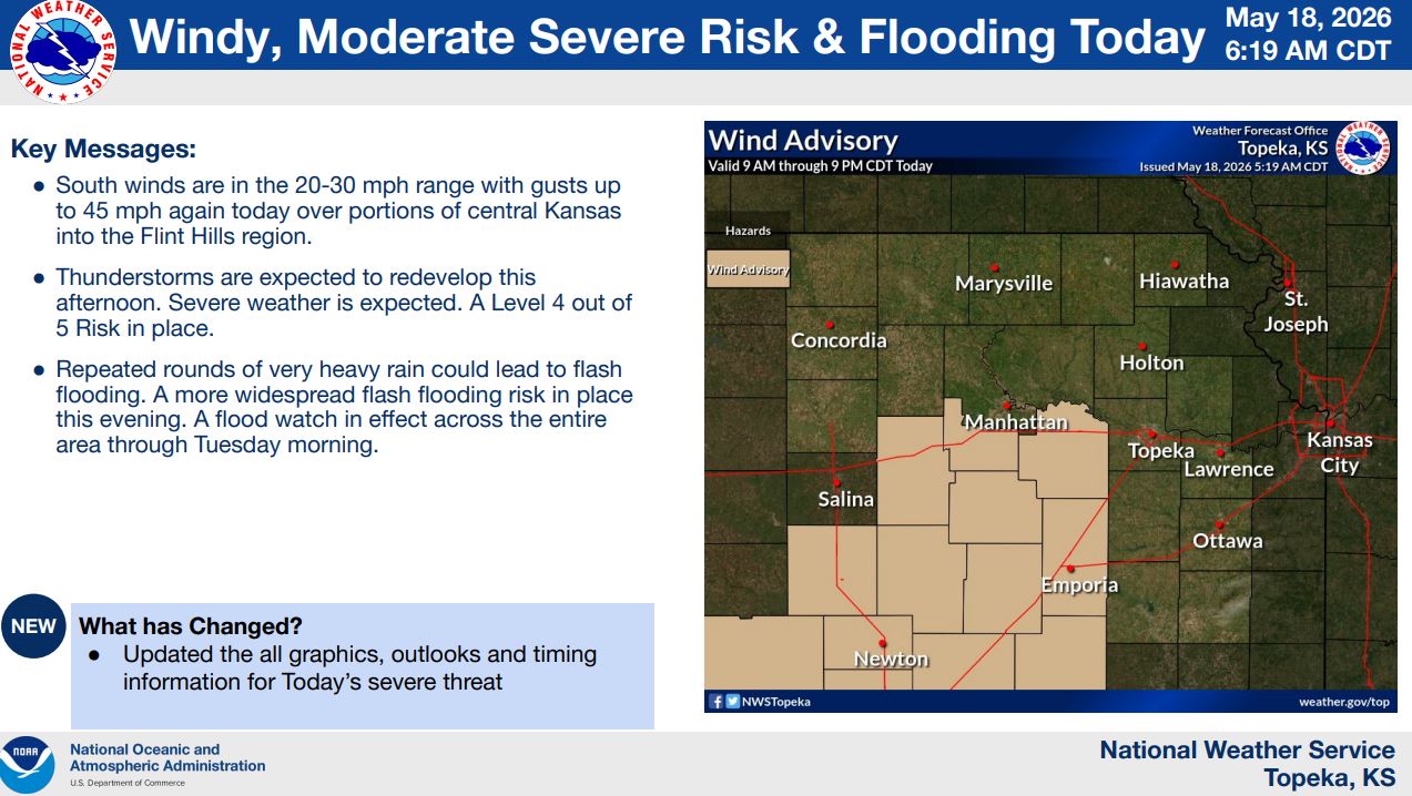
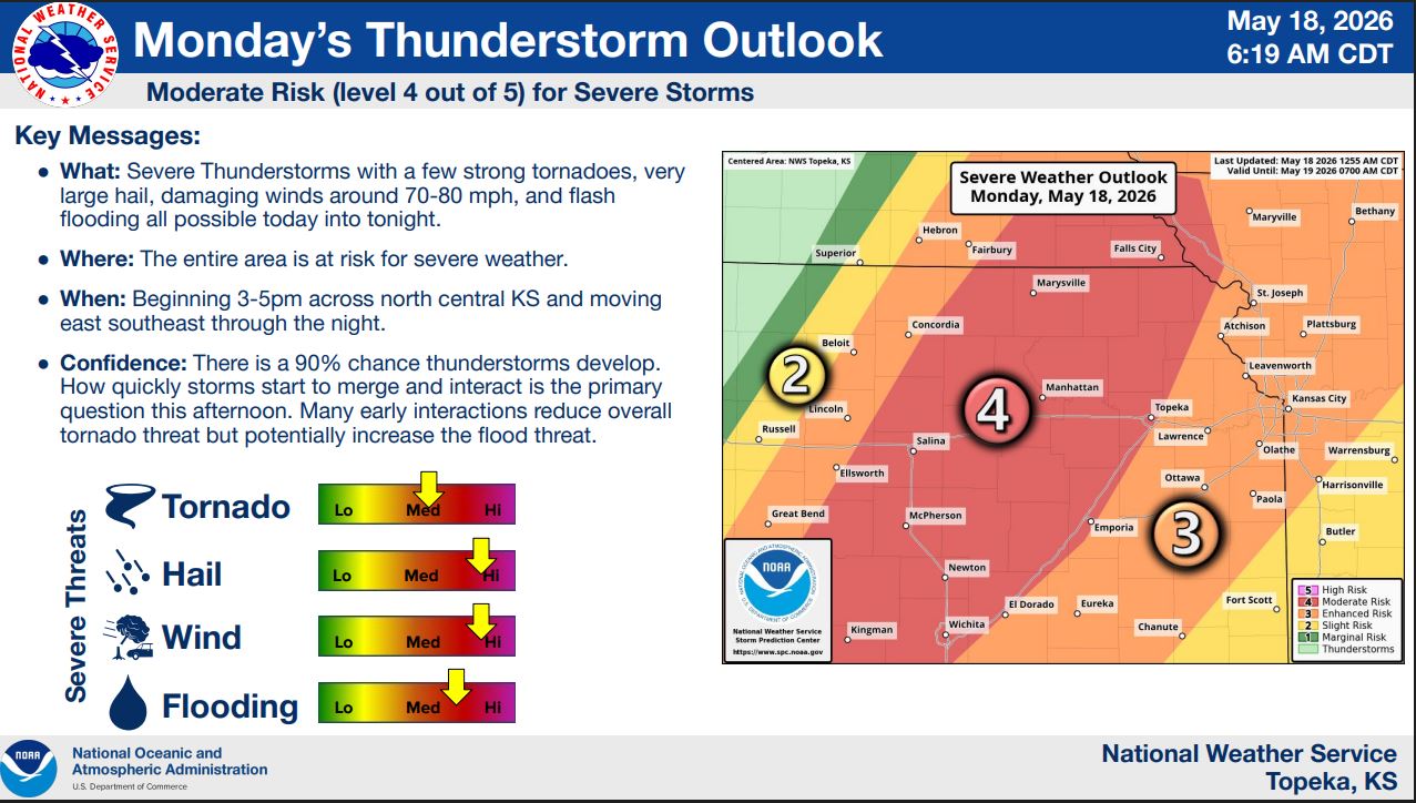
Forecasters have placed much of the region under a moderate risk, or level 4 out of 5, for severe storms. The National Weather Service says there is a 90% chance thunderstorms develop Monday afternoon and evening.
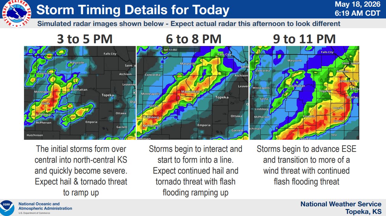
Storms are expected to begin developing between 3 and 5 p.m. across north-central Kansas before moving east-southeast through the night. The initial storms are expected to rapidly become severe, with the tornado threat highest during the early evening hours.
The weather service warned that a few strong tornadoes are possible, along with hail up to softball size and wind gusts of 70 to 80 mph or greater.
As storms begin to merge into a line later in the evening, the threat is expected to transition more toward damaging winds and flash flooding. Forecasters say repeated rounds of heavy rain could create a more widespread flooding risk across the region, especially in areas that have already received significant rainfall over the weekend.
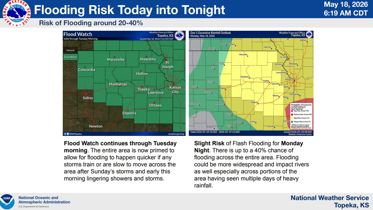
A flood watch remains in effect through Tuesday morning for the entire area. The National Weather Service says flooding could develop more quickly because soils are already saturated from previous storms.
South winds of 20 to 30 mph with gusts up to 45 mph are also expected Monday across portions of central Kansas into the Flint Hills region.
Residents are encouraged to remain weather aware throughout the day, review severe weather safety plans and have multiple ways to receive warnings.
Stay tuned to News Radio KMAN for the latest updates.
The post Strong tornadoes, giant hail possible Monday across northeast Kansas appeared first on News Radio KMAN.