

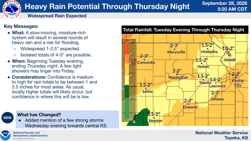


Several rounds of heavy rain could bring a risk of flooding to northeast and north-central Kansas beginning Tuesday evening and continuing through Thursday night.
The National Weather Service in Topeka says a slow-moving, moisture-rich system is expected to produce widespread rainfall totals of 1 to 2.5 inches, with isolated amounts of 4 to 5 inches possible. A few light showers could linger into Friday.
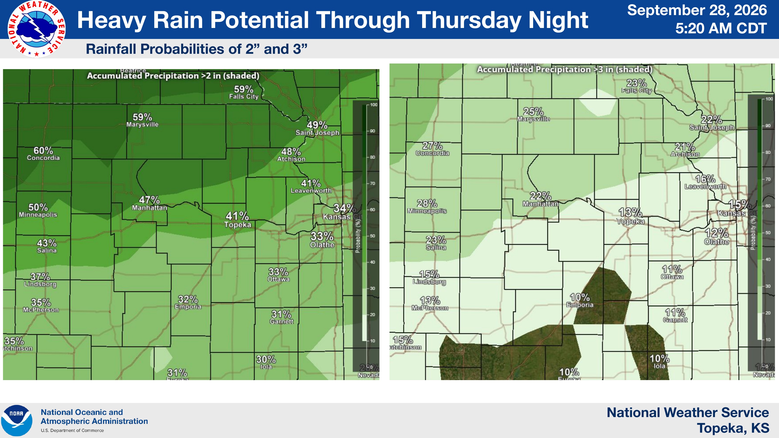
The Manhattan area is forecast to receive between 2 and 3 inches of rain. The Weather Service puts the probability of receiving more than 2 inches in Manhattan at 47%, while the probability of more than 3 inches is 22%, according to forecast maps included in Monday’s outlook.
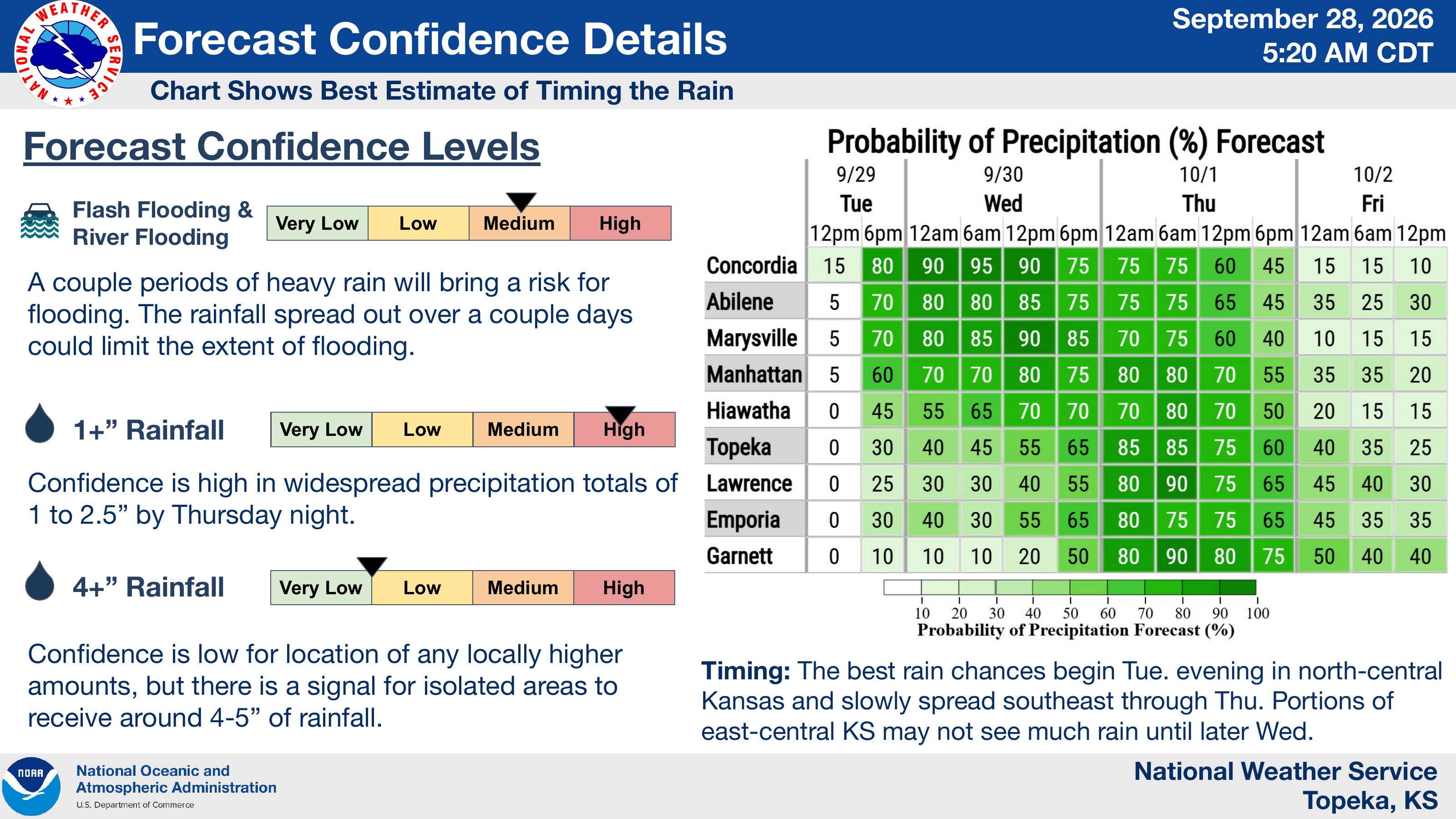
Rain chances are expected to begin Tuesday evening in north-central Kansas before slowly spreading southeast through Thursday. Forecasters said a couple periods of heavy rain could produce flooding, although spreading the rainfall over several days could limit the extent of flooding.
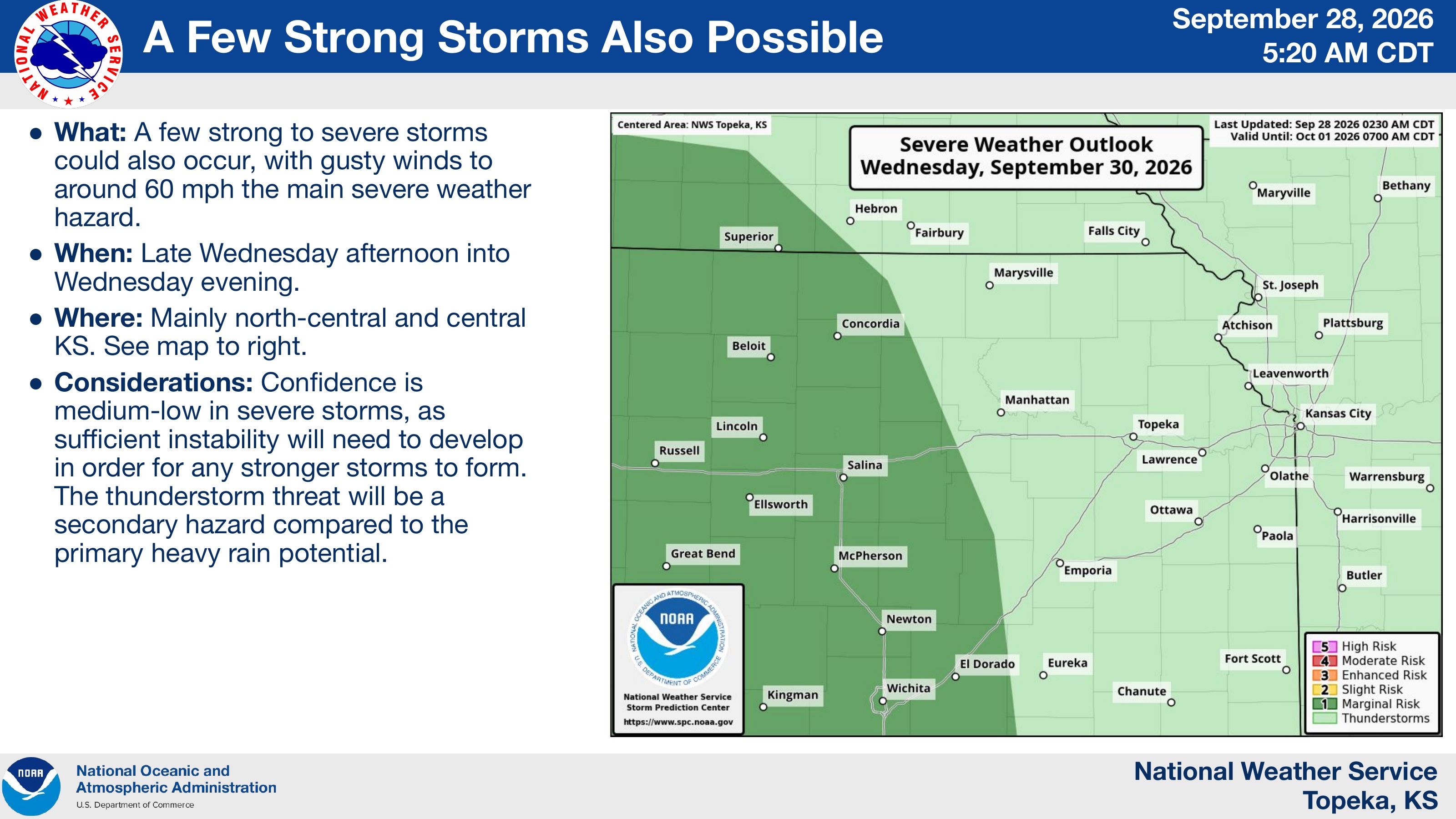
A few strong to severe thunderstorms are also possible late Wednesday afternoon and evening, primarily across north-central and central Kansas. Wind gusts around 60 mph would be the primary severe weather threat. Forecasters said confidence in severe storms is medium-low, with heavy rainfall remaining the primary weather concern.
The post Heavy rain, flooding risk expected across northeast Kansas through Thursday appeared first on News Radio KMAN.
