

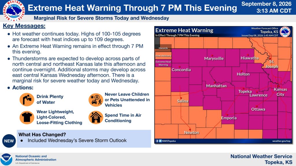


Dangerous heat will continue across northeast Kansas Tuesday, with the potential for severe thunderstorms developing later in the day.
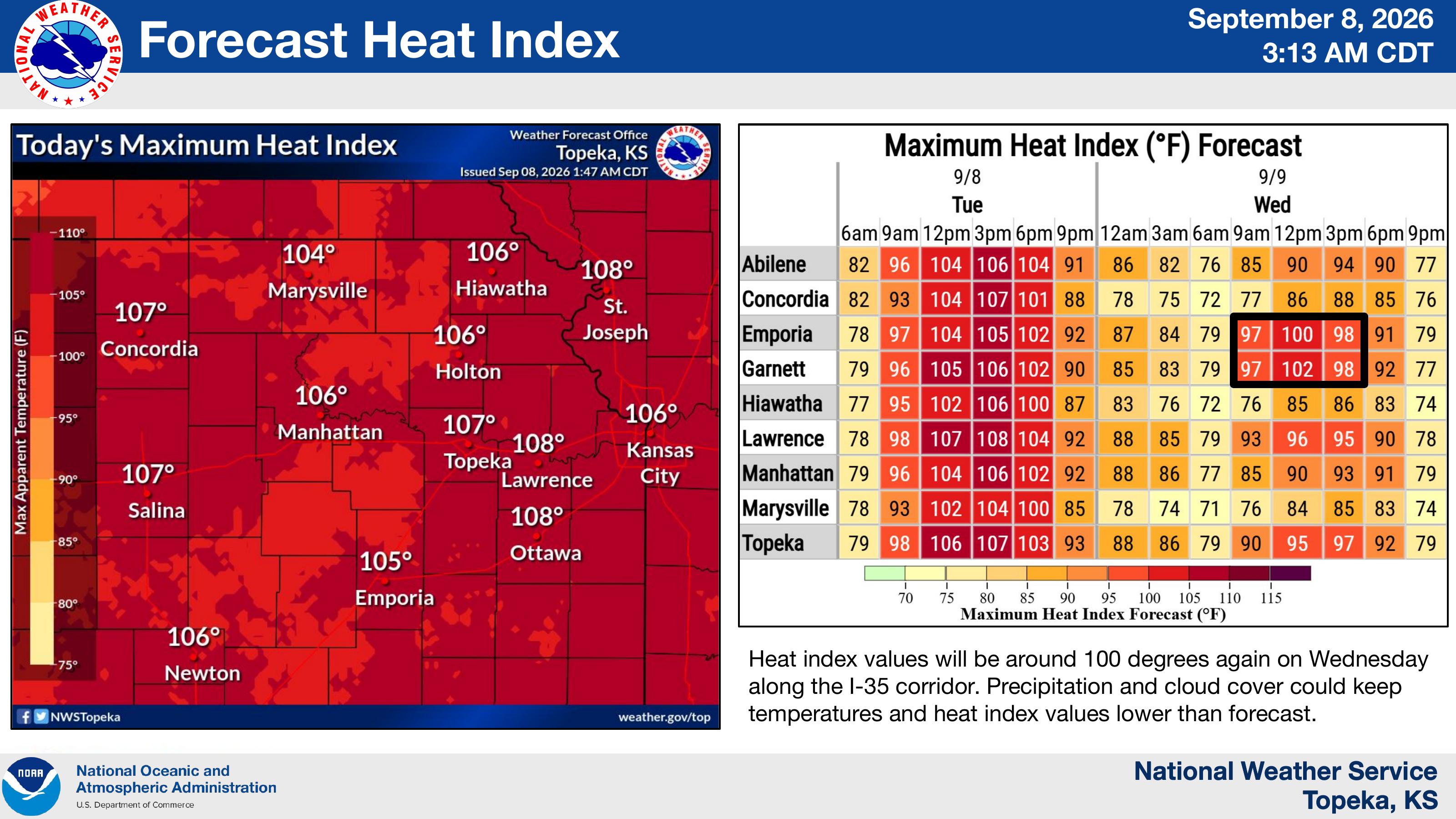
The National Weather Service in Topeka says an Extreme Heat Warning remains in effect through 7 p.m. Tuesday. High temperatures are expected to reach 100 to 105 degrees, with heat index values as high as 109 degrees.
In Manhattan, the heat index is forecast to reach about 106 degrees Tuesday. Heat index values could approach 100 degrees again Wednesday, although clouds and precipitation could keep temperatures lower than forecast.
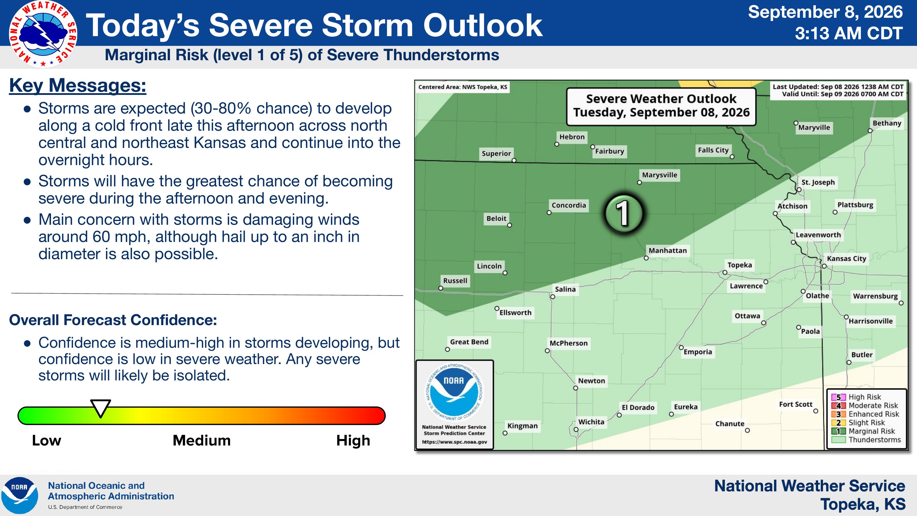
Thunderstorms are expected to develop along a cold front late Tuesday afternoon across north-central and northeast Kansas and continue into the overnight hours. The area is under a marginal, level 1 of 5, risk for severe thunderstorms. Damaging winds around 60 mph are the primary concern, with hail up to an inch in diameter also possible.
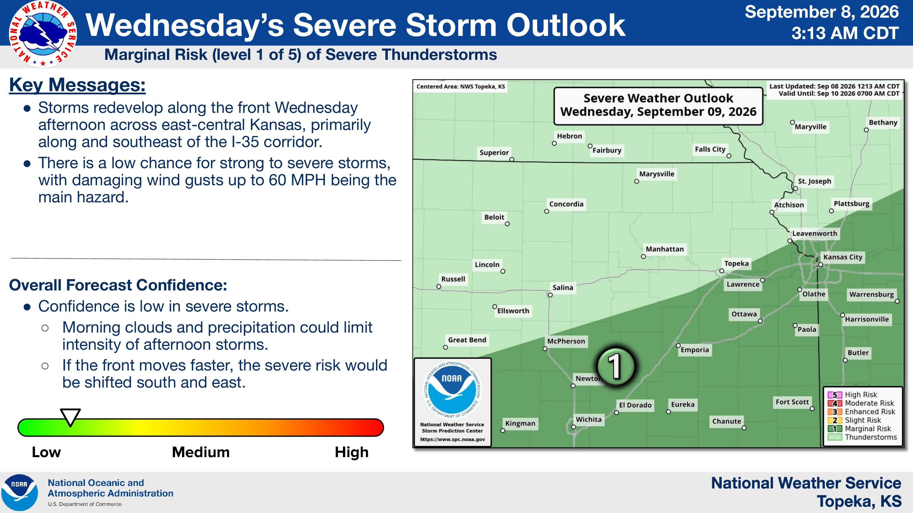
The Weather Service says additional storms could develop Wednesday afternoon across east-central Kansas, primarily along and southeast of the Interstate 35 corridor. Those storms could also produce damaging wind gusts up to 60 mph, though confidence in severe weather remains low.
The post Extreme heat continues as severe storms possible in northeast Kansas appeared first on News Radio KMAN.
