
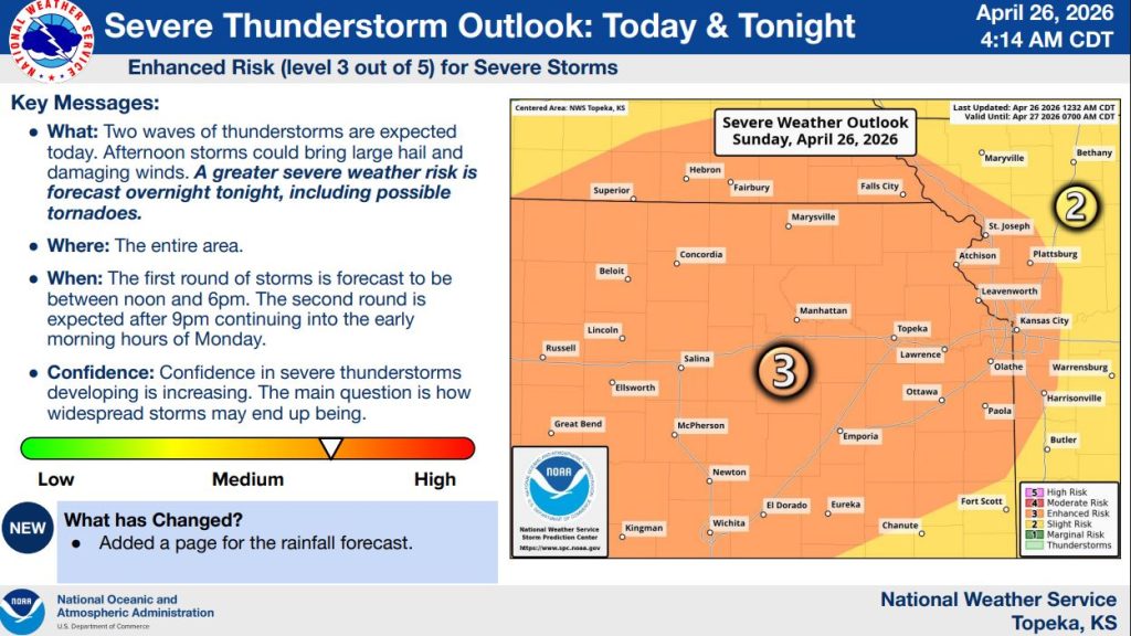


Severe thunderstorms are expected to impact the region in two waves today and into early Monday, with the National Weather Service placing much of northeast Kansas under an enhanced risk for severe weather.
Forecasters say the first round of storms is expected between noon and 6 p.m., with activity developing across central Kansas and moving east and northeast at around 25 mph. These afternoon storms could produce large hail and damaging wind gusts, though a tornado cannot be ruled out.
A second, more significant round of storms is expected to develop after 9 p.m. and continue into the early morning hours of Monday. The overnight period is expected to bring a greater risk for severe weather, including the potential for tornadoes that may persist through the night.
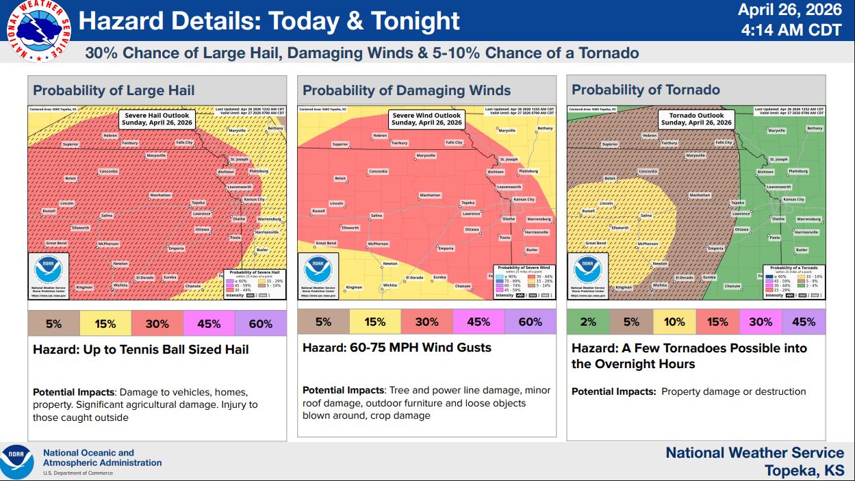
According to the forecast graphics on page 2, there is about a 30% chance for large hail and damaging winds, with hail potentially reaching the size of tennis balls and wind gusts between 60 and 75 mph. The probability of tornadoes ranges from 5% to 10%, with a few tornadoes possible into the overnight hours.
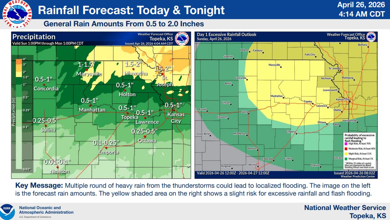
In addition to severe weather, multiple rounds of thunderstorms are expected to bring widespread rainfall totals between a half inch and 2 inches, with locally higher amounts possible. This could lead to localized flooding, particularly where storms repeatedly track over the same areas.
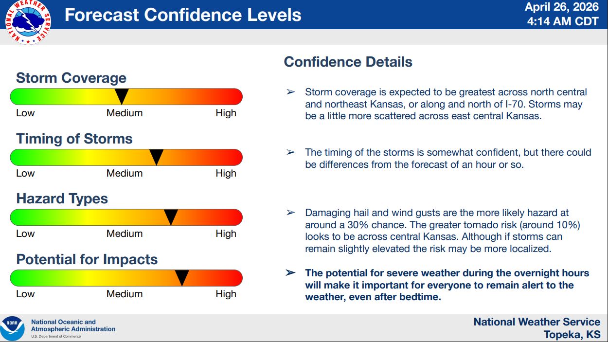
Confidence is increasing that severe thunderstorms will develop, though some uncertainty remains regarding how widespread storms will become and the exact timing of each round. Forecasters note that the overnight threat will make it especially important for residents to stay alert to changing conditions, even after going to bed.
Stay tuned to News Radio KMAN for the latest updates.


The post Severe storms expected in two rounds across northeast Kansas today and overnight appeared first on News Radio KMAN.