

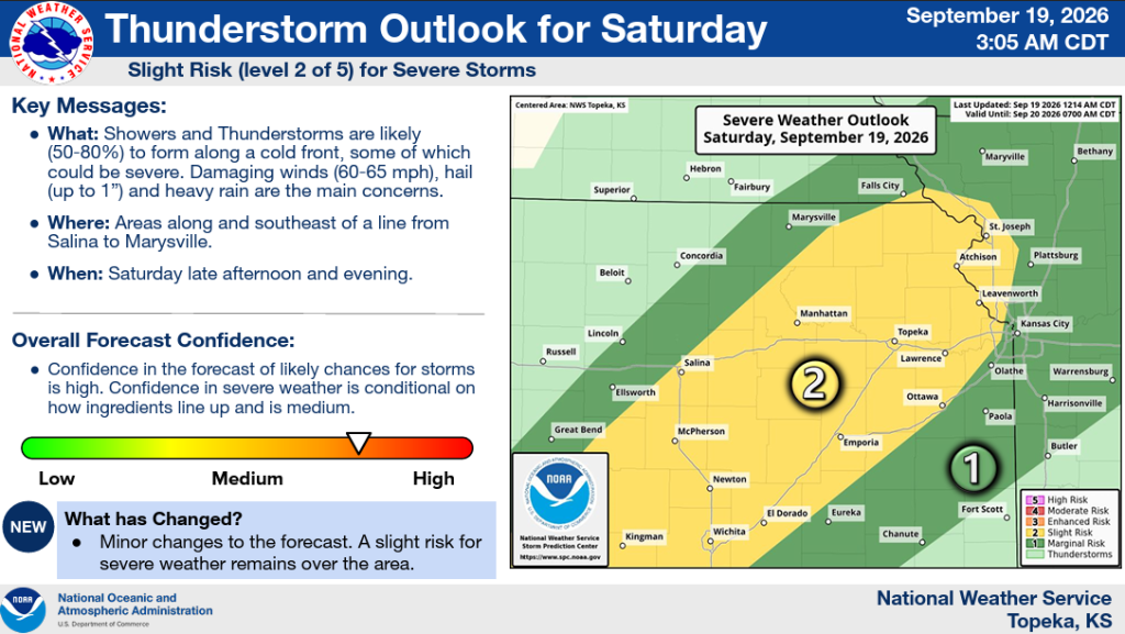


Strong to severe thunderstorms could develop across northeast and east-central Kansas Saturday evening, bringing a threat of damaging winds, hail and heavy rainfall.
The National Weather Service in Topeka says areas along and southeast of a line from Salina to Marysville are under a slight, or Level 2 of 5, risk for severe thunderstorms. That includes the Manhattan area.
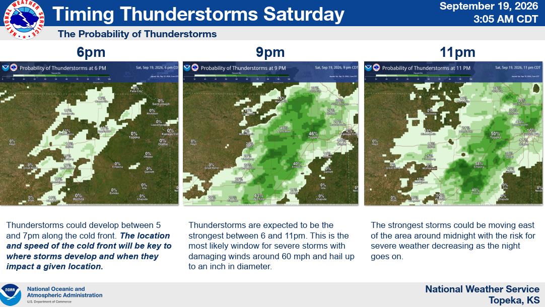
Forecasters say storms could begin developing between 5 and 7 p.m. along a cold front, with the location and speed of the front determining where and when storms develop.
The strongest storms are expected between 6 and 11 p.m. Damaging winds of 60 to 65 mph and hail up to 1 inch in diameter are the primary severe weather threats, along with heavy rainfall.
The strongest storms are expected to move east of the area around midnight, with the severe weather threat decreasing as the night continues.
The National Weather Service says confidence is high that thunderstorms will develop, while confidence in severe weather is considered medium and will depend on how conditions develop Saturday.
The post Severe storms possible Saturday evening across northeast Kansas appeared first on News Radio KMAN.
